

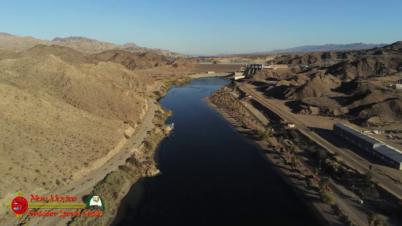
Davis Dam is a dam on the Colorado River about 70 miles downstream from Hoover Dam. It stretches across the border between Arizona and Nevada. Originally called Bullhead Dam, Davis Dam was renamed after Arthur Powell Davis, who was the director of the U.S. Bureau of Reclamation from 1914 to 1923.
Lake Mohave on the Arizona/Nevada border is amazing with 240 miles of shoreline, spreading 67 miles from end to end, with Cottonwood Cove Resort & Marina located right in the center. It begins at Davis Dam in Bullhead City, Arizona and is just 14 miles east of historic Searchlight, Nevada, only 45 minutes north of Laughlin and an hour south of Las Vegas.
The 67 mile long reservoir covers approximately 30,000 surface acres to a maximum depth of 120 feet. There are three marinas with launch ramps, two in Arizona (Willow Beach and Katherine’s Landing) and one in Nevada (Cottonwood Cove). There is also a launch ramp at Princess Cove on the Arizona side near Katharine’s landing. Camping is available at Cottonwood Cove and Katherine’s Landing. Shoreline camping is permitted. Campers should carry out their trash and provide for adequate sanitation.Both narrow and shallow compared to Lake Mead, Lake Mohave lies between the Black Mountains to the east in northwestern Arizona, and the Eldorado and Newberry Mountains to the west in southern Nevada. Most of the lake’s length lies within the steep, narrow walls of Black, Eldorado, Painted, and Pyramid canyons.
Bullhead City is a city located on the Colorado River in Mohave County, Arizona, United States, roughly 90 mi south of Las Vegas, Nevada, and directly across the Colorado River from Laughlin, Nevada, whose casinos and ancillary services supply much of the employment for Bullhead City.
The Colorado River is one of the principal rivers in the Southwestern United States and northern Mexico. The 1,450-mile-long river drains an expansive, arid watershed that encompasses parts of seven U.S. states and two Mexican states.
From its genesis on the Continental Divide in Colorado’s Rocky Mountain National Park, the river originally known as the Grand grows from a cold mountain trout stream into a classic Western waterway slicing through jagged gorges between sweeping, pastoral ranchlands on the upper leg of a 1,450-mile journey.
Its stature continues to swell as it carves through some of the planet’s most iconic landscapes—desert canyons, buttes, and mesas—before being bottled up and sucked dry by agriculture and municipal demand. Its once-mighty flow ends, in fact, several miles shy of the Gulf of California in Mexico.
For more than a thousand miles of its course, the Colorado has cut a deep gorge. Where the river system is joined by lateral streams—the Virgin, Kanab, Paria, Escalante, Dirty Devil, and Green rivers from the west, and the Little Colorado, San Juan, Dolores, and Gunnison from the east—a transverse system of narrow, winding deep canyons has been cut. Each entering river and each lateral creek has cut another canyon, and thus the upper and middle parts of the Colorado basin are traversed by a labyrinth of deep gorges. The longest of these unbroken trunk canyons through which the Colorado flows is the spectacular Grand Canyon, extending from the mouth of the Paria to the Grand Wash Stream. Other canyons cut by the river include Marble Canyon, Glen Canyon, and Cataract Canyon. Canyonlands National Park encompasses another of these regions at the juncture of the Green and Colorado rivers in southeastern Utah.


0 Comments