Following the Colorado River Into the Greatest Canyon of Them All
Every now and then on this Colorado River journey, I have to remind myself that we're still following the same water.
High in Rocky Mountain National Park, Paulette and I watched the Colorado begin as a cold mountain stream wandering through the Kawuneeche Valley.
We followed it into Grand Lake and Granby, through Kremmling and Glenwood Canyon, past Grand Junction and into the red-rock movie country around Moab.
Then came Canyonlands, Cataract Canyon and Lake Powell.
Now we stand near Page, Arizona, and the Colorado is about to perform another remarkable transformation.
Above Glen Canyon Dam is a sprawling desert reservoir filled with striped bass, smallmouth, largemouth and walleye.
Below the dam?
Cold trout water.
And just downstream waits something considerably larger.
Grand Canyon.
I've spent most of my life being drawn toward places where mountains, deserts, wildlife and water come together. Maybe some of that goes back to my boyhood on Kansas ranches, where weather and water weren't abstract subjects. They determined what happened on the land.
Many years later, after Paulette and I built our log home high above New Mexico's Moreno Valley, those connections became even stronger. I could sit there looking toward Wheeler Peak, Bobcat Pass and Eagle Nest Lake and never tire of watching weather move across the mountains.
Now, in my eighties, I find myself following another landscape through a camera lens.
But Grand Canyon is troublesome for a photographer.
It won't fit.
You can own the widest lens in the camera bag, stand on the rim and still come away feeling you've photographed only a sentence from a very long book.
So let's forget about capturing all of it.
Instead, let's follow the Colorado River through it.
Glen Canyon Dam Changes the Colorado River
Our previous journey through the Colorado River from Moab to Page and Lake Powell brought us to Glen Canyon Dam and one of the great dividing lines in the river's ecology.
Lake Powell stores water behind the dam.
Deep in the reservoir, water remains considerably colder than the sun-warmed surface.
Releases from Glen Canyon Dam therefore create a cold tailwater below it.
The result is one of the strangest ecological transitions on our entire trip.
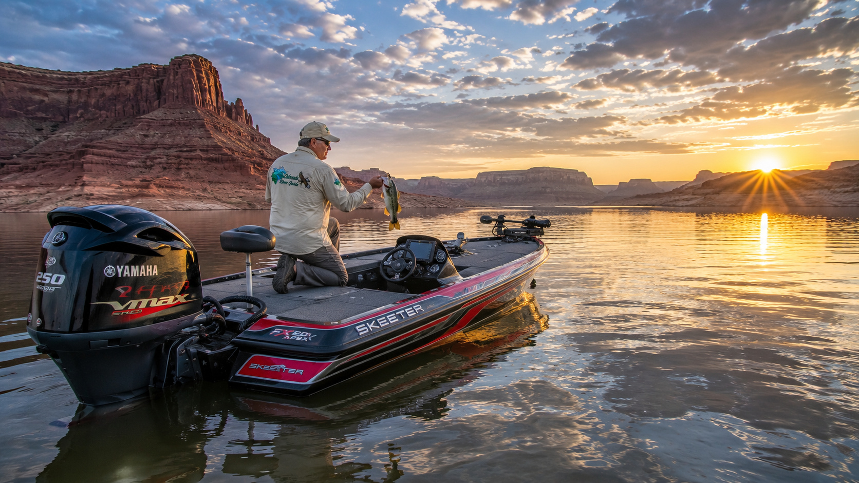
Upstream, I'm fishing Lake Powell for bass and stripers.
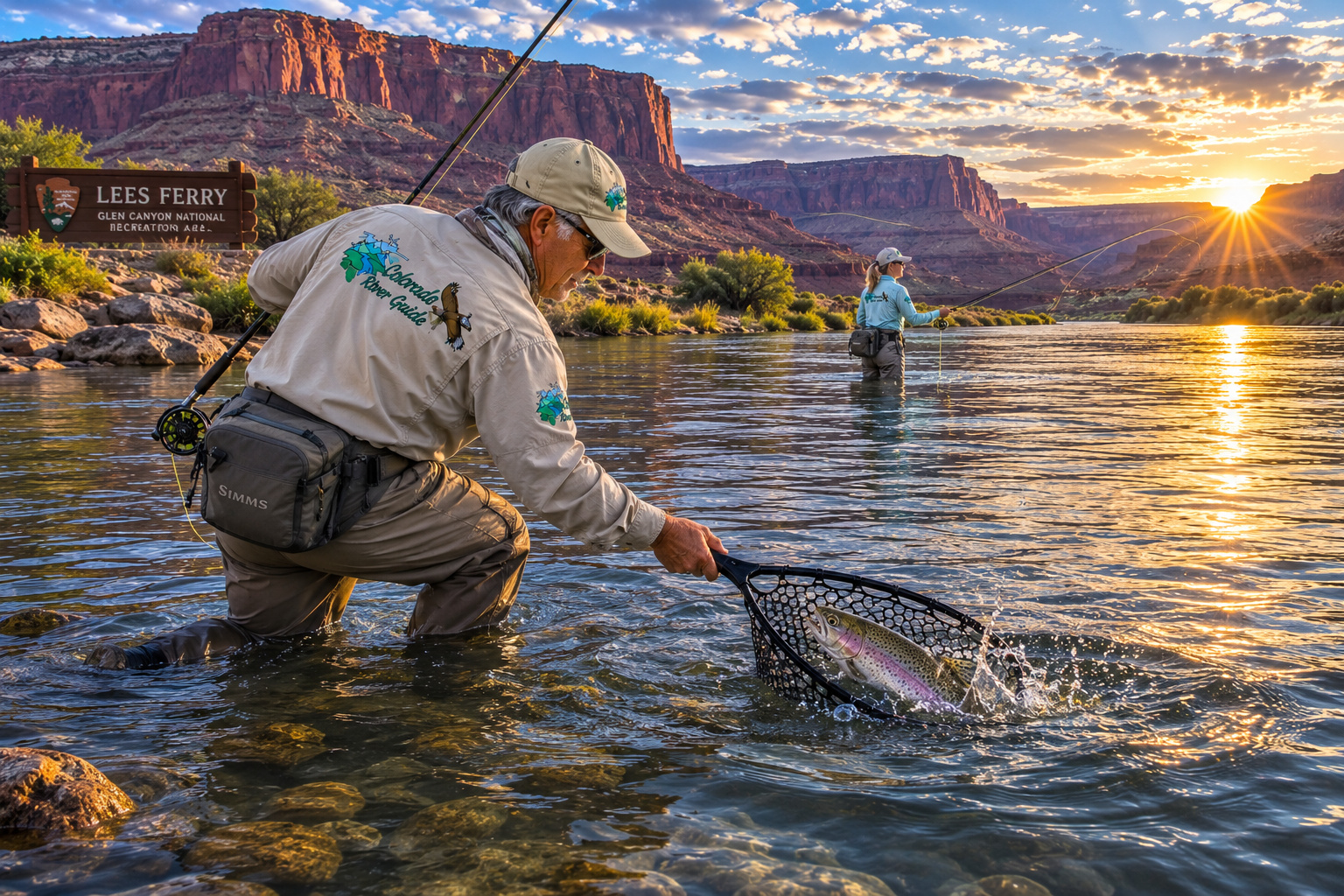
Downstream, I'm reaching for a fly rod and looking for rainbow trout.
Same Colorado River.
Different world.
Glen Canyon Dam has also profoundly changed the river's natural rhythm. Before completion of the dam in 1963, spring floods carried enormous quantities of sand, silt and clay through Grand Canyon. Today the dam traps much of that sediment, while regulated releases control much of the mainstem flow below it. High-flow experiments are sometimes used to redistribute sediment and rebuild beaches and sandbars downstream. (USGS)
That matters to fishermen, rafters, wildlife, native fish, archaeological sites and everyone camping beside the river.
The modern Grand Canyon Colorado is still wild country.
But its river is regulated.
Lees Ferry: Where Two Colorado Rivers Meet
About 15 river miles below Glen Canyon Dam lies Lees Ferry.
If there is a doorway into Grand Canyon, this is it.
The National Park Service describes Lees Ferry as the only location in more than 700 miles of canyon country where visitors can drive directly to the Colorado River, right up to the beginning of Grand Canyon's whitewater corridor. (National Park Service)
That's quite a distinction.
The place has been a crossing, ferry site, settlement, fishing destination and river-launching point.
Today, great rubber rafts sit beside fishing boats at the ramp.
Upstream, anglers head toward Glen Canyon Dam.
Downstream, expedition rafts point toward Grand Canyon.
Two very different adventures begin from essentially the same patch of riverbank.
That appeals to me.
I've always liked crossroads.
Lees Ferry just happens to be a crossroads made of water.
The Lees Ferry Trout Fishery
The 15-mile reach between Lees Ferry and Glen Canyon Dam is one of Arizona's best-known tailwater trout fisheries.
Rainbow trout are the principal sport fish.
Brown trout are also present, although fishery managers treat brown trout differently because of concerns about their expansion downstream and predation on native fishes.
Rainbow trout themselves are not native to the Colorado River. They were introduced and have developed into an important recreational fishery, but their relationship with native Grand Canyon fishes requires continuing management. (USGS)
For me, Lees Ferry fishing is primarily about reading moving water.
I look for seams.
Current breaks.
Back eddies.
Drop-offs.
Submerged structure.
Changes in depth.
And anywhere trout can hold without spending more energy than the food drifting toward them is worth examining.
Fishing Regulations Matter Here
The river immediately upstream from Lees Ferry has special rules.
NPS currently states that anglers need an Arizona fishing license and must use artificial flies and lures with barbless hooks in this reach. Anglers should also check current Arizona regulations and the status of the Brown Trout Incentivized Harvest program before fishing. (National Park Service)
That suits my philosophy nicely.
I increasingly prefer fishing in a way that gives a released trout every reasonable chance of swimming away healthy.
My Fly-Fishing Outfit for Lees Ferry
For most of the river, I would start with a 9-foot 5-weight fly rod.
A 6-weight can be useful when wind becomes troublesome or heavier rigs are required.
I'd pair it with a quality disc-drag reel carrying plenty of backing.
For line, a weight-forward floating line handles most nymphing and dry-fly situations.
A fluorocarbon tippet can be valuable underwater, particularly in clear conditions.
I would carry leaders and tippet ranging roughly from 3X through 6X depending upon flies, current and fish behavior.
Flies and Nymphs
My fly boxes would include:
- Zebra midges
- Midge larvae and pupae
- Scuds
- San Juan worms
- Small mayfly nymphs
- Pheasant tails
- Hare's ears
- Small streamers
- Terrestrial patterns when appropriate
- Dry flies matching whatever happens to be emerging
Lees Ferry trout often feed heavily on small aquatic organisms, so tiny flies can outperform something that looks more impressive to the fisherman.
That's one of fly fishing's little lessons in humility.
The trout gets the final vote.
Spinning Tackle for Colorado River Trout
I'm just as comfortable carrying spinning tackle.
A 6½- to 7-foot light or medium-light spinning rod paired with a smooth 2000- or 2500-size reel makes a versatile river outfit.
I'd use 4- to 8-pound monofilament or fluorocarbon, or light braid with a fluorocarbon leader.
Where regulations allow, productive artificial lures can include small:
- Inline spinners
- Spoons
- Minnow-style plugs
- Small jigs
- Trout-sized crankbaits
Silver, gold, rainbow-trout patterns, black, brown and natural baitfish colors all deserve space in my box.
But remember that the Lees Ferry special-regulation water requires artificial flies and lures with barbless hooks. (National Park Service)
The Most Important Piece of Tackle: Respect
A trout I'm releasing doesn't need to spend five minutes posing for my camera.
My routine is simple.
Use barbless hooks.
Use a rubber net rather than an abrasive knotted nylon net.
Keep the trout fully submerged while removing the hook whenever practical.
If I must touch it, I handle it only with wet hands.
Never squeeze the fish.
Never put fingers into its gills.
If I'm taking a photograph, I have the camera ready first.
Lift.
Photograph.
Back into the water.
Then I hold the trout facing into gentle current until it is strong enough to leave under its own power.
I like photographs.
I like healthy trout more.
Productive Trout Water Temperatures
Cold-water trout generally feed well through a broad range, but I particularly like water in approximately the mid-40s through upper-50s Fahrenheit.
As trout water moves into the 60s, I become increasingly cautious.
Once water becomes unusually warm, catch-and-release mortality becomes a serious concern.
Lees Ferry is unusual because Glen Canyon Dam releases cold reservoir water, giving this desert fishery a temperature regime unlike nearby surface waters.
Best Time of Day
I still favor the old standards:
Early morning and late afternoon.
Low light often makes trout more comfortable.
Wind can be lighter.
Summer temperatures are easier on the fisherman.
But dam releases, insect activity, cloud cover and current conditions can make midday fishing surprisingly productive.
I fish conditions rather than my wristwatch.
Boating Above Lees Ferry
Boaters can travel approximately 15 miles upstream from Lees Ferry toward Glen Canyon Dam, although a closure zone near the dam itself must be respected.
A free Lees Ferry Backcountry Permit is required for watercraft traveling the river between Lees Ferry and Glen Canyon Dam, and there are five designated primitive camping areas along that upstream reach. (National Park Service)
This makes for a magnificent boat trip.
Sandstone walls rise directly from the river.
The water below is startlingly clear in places.
Ospreys may circle overhead.
Trout hold beneath the surface.
The desert above can be brutally hot while the river remains cold enough to make an unexpected swim dangerous.
A life jacket belongs on you, not underneath a seat.
Marble Canyon and Navajo Bridge
Immediately downstream from Lees Ferry, the walls begin tightening.
Welcome to Marble Canyon.
The name is misleading geologically because much of what early explorers called marble is limestone, but the name stuck.
Highway 89A crosses the Colorado at Navajo Bridge, providing one of the few opportunities to look almost straight down upon the river before it disappears into the deeper Grand Canyon.
I would stop.
Walk the bridge.
Bring binoculars.
And bring the camera.
This area is also famous for California condors.
A bird with nearly a ten-foot wingspan riding canyon thermals is not something I casually drive past.
The Paria River Joins the Colorado
Near Lees Ferry, the Paria River enters the Colorado.
It may not look impressive beside the main river during ordinary conditions, but desert tributaries have personalities that change quickly.
Flash floods can send tremendous amounts of sediment downstream.
That sediment matters because Glen Canyon Dam traps so much of the material that historically came from the upper Colorado watershed.
Farther downstream, tributaries become increasingly important sources of sediment.
And there are many.
NPS identifies major perennial tributaries within Grand Canyon including the Little Colorado River, Kanab Creek, Havasu Creek and Paria River, while numerous other drainages are intermittent or ephemeral. (National Park Service)
The river gathers the desert one canyon at a time.
Entering Grand Canyon
Eventually Marble Canyon becomes Grand Canyon, although the Colorado River doesn't stop for a sign.
The scale simply grows.
Grand Canyon stretches roughly 277 river miles, reaches as much as about 18 miles across, and approaches a mile in depth. The Colorado has been cutting through the uplifted landscape for millions of years, exposing a geological record of astonishing age. (National Park Service)
Down near river level are ancient rocks including Vishnu Schist approximately 1.7 billion years old. (National Park Service)
I have trouble getting my mind around that.
A human lifetime seems considerable while you're living it.
Put eighty-some years beside 1.7 billion and suddenly I'm approximately yesterday afternoon.
That perspective may be one of Grand Canyon's finest gifts.
Ancient Man and the Colorado River
Calling this wilderness "untouched" would erase a very important part of its history.
People have lived in, traveled through and depended upon Grand Canyon country for thousands of years.
NPS archaeological interpretation describes Paleo-Indians in the region thousands of years ago, followed by Archaic peoples, Basketmakers and Ancestral Puebloan communities. People hunted, gathered wild foods, farmed corn, beans and squash, established trails and settlements and traded across the canyon. (National Park Service)
The canyon wasn't an obstacle separating human beings from nature.
It was home.
Today 11 federally recognized tribes are traditionally associated with Grand Canyon, including the Havasupai, Hualapai, Hopi, Navajo, several Southern Paiute communities, Zuni and Yavapai-Apache. (National Park Service)
Those relationships aren't merely archaeological.
They are living cultural relationships.
That's important.
I don't want to write about Native people as though they disappeared when an archaeological period ended.
They're still here.
The Little Colorado River
About 60 miles downstream from Lees Ferry, the Little Colorado River joins the Colorado.
Its watershed reaches eastward across northern Arizona toward the White Mountains.
The Little Colorado has a remarkable human history. NPS notes prehistoric use dating back roughly 8,000 years and identifies the drainage as potentially one of the earliest Southwestern areas where maize agriculture was adopted. (National Park Service)
It also plays an enormously important ecological role.
The Little Colorado provides critical habitat for the endangered humpback chub, one of the Colorado River's remarkable native fishes.
This is one reason fish management in Grand Canyon is complicated.
We're balancing a popular nonnative trout fishery with conservation of native fishes that evolved here long before rainbow or brown trout arrived.
Whitewater Rafting the Grand Canyon
Now the Colorado begins showing its teeth.
A full Grand Canyon river trip is one of America's great wilderness adventures.
Commercial and private expeditions launch from Lees Ferry.
Commercial trips through the canyon typically range from 3 to 18 days, depending upon craft and itinerary. Private noncommercial trips from Lees Ferry to Diamond Creek commonly run 12 to 25 days, with permits awarded through a weighted lottery. Motorized trips generally require at least seven days to reach Diamond Creek. (National Park Service)
Think about that.
Days without roads.
No convenience store.
No motel.
No easy exit.
Your world becomes:
River.
Raft.
Canyon.
Camp.
Sky.
That's a pretty good world.
Grand Canyon Rapids
The Colorado drops through famous rapids including stretches known to generations of river runners.
The Grand Canyon traditionally uses its own 1-to-10 rapid rating system, rather than relying solely on the international Class I-VI system familiar elsewhere.
Water level changes everything.
A rapid that's difficult at one flow may behave differently at another.
Rocks disappear.
Other waves grow.
Hydraulics change.
For someone unfamiliar with Grand Canyon whitewater, this is absolutely not a place for experimentation.
Hire an experienced commercial outfitter or travel with people who genuinely know the river.
There's a substantial difference between adventure and improvising yourself into a rescue.
Water Levels Through Grand Canyon
Below Glen Canyon Dam, Colorado River flow is heavily influenced by dam operations.
That means the river doesn't simply rise and fall according to local weather.
Releases respond to water-management requirements, reservoir conditions, hydropower operations and occasional experimental flows.
NPS directs river users to current Bureau of Reclamation and USGS information for real-time and projected flows, including the Lees Ferry gauge. (Grand Canyon River Permits)
I strongly recommend checking current flow before any fishing or boating trip.
A permanent article should not tell you today's cubic-feet-per-second number and pretend it's useful next spring.
The river gets the last word.
Camping Along the Colorado River
Camping inside Grand Canyon from a raft is an experience very different from pulling an RV into a developed campground.
River parties use designated or appropriate beaches and camps according to permit rules and trip itineraries.
Everything necessary travels downstream with the group.
Food.
Water-treatment equipment.
Shelter.
Waste-management equipment.
Emergency supplies.
Personal gear.
The philosophy is simple:
Leave the canyon looking as though you were never there.
At Lees Ferry, the NPS campground provides the easiest developed camping near river level. In 2026, however, the upper campground loop is closed for renovations through September 30, while the lower loop remains open subject to current conditions. (National Park Service)
Wildlife Along the Colorado River
For Paulette and me, wildlife can turn a planned fishing stop into a photography expedition rather quickly.
Grand Canyon spans an extraordinary range of elevations and habitats. NPS notes that five of North America's seven life zones occur within the canyon landscape. (National Park Service)
Along our journey I watch for:
- Desert bighorn sheep
- Mule deer
- Elk at higher elevations
- Coyotes
- Bobcats
- Mountain lions
- Ringtails
- Beavers
- Bats
- California condors
- Golden eagles
- Bald eagles seasonally
- Peregrine falcons
- Red-tailed hawks
- Great blue herons
- Ravens
- Waterfowl
Bighorn sheep are particularly exciting along the river.
They negotiate cliff faces that would make me reconsider my entire afternoon.
And California condors deserve special attention around Marble Canyon and the canyon rims.
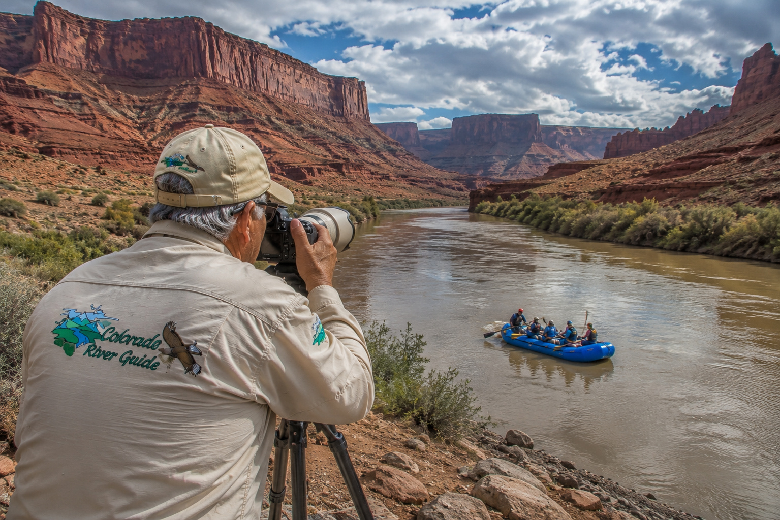
A telephoto lens is made for days like these.
Havasu Creek
Farther downstream lies one of Grand Canyon's most famous tributaries.
Havasu Creek.
Its blue-green water provides a dramatic contrast with the Colorado.
But Havasu Creek is far more than a beautiful photograph.
It is the ancestral and present homeland of the Havasupai people.
NPS fisheries managers have also used portions of Havasu Creek in efforts to establish additional populations of native humpback chub because its habitat and water chemistry resemble portions of the Little Colorado. (National Park Service)
Access to Havasupai lands is governed by the Tribe.
Visitors should never treat tribal land as ordinary public recreation property.
Check current tribal requirements and obtain the necessary reservations or permits before visiting.
The Hualapai Indian Reservation
As the Colorado River travels west through the lower reaches of Grand Canyon, we enter country deeply connected with the Hualapai people.
The Hualapai relationship with Grand Canyon and the Colorado River reaches far beyond modern tourism.
The river and canyon occupy important places in Hualapai history, identity and oral traditions. Grand Canyon National Park recognizes the Hualapai as one of the eleven traditionally associated tribal nations. (National Park Service)
The Hualapai Reservation encompasses a large portion of canyon country south of the Colorado.
And here we encounter something entirely different from Grand Canyon National Park.
Grand Canyon West.
Grand Canyon West Skywalk
The Grand Canyon West Skywalk extends visitors beyond the canyon rim on a horseshoe-shaped glass walkway.
The experience is located on Hualapai tribal land rather than inside Grand Canyon National Park.
For someone who enjoys heights, the transparent floor provides a remarkable perspective into the canyon.
For someone who doesn't enjoy heights?
Well, there's always the perfectly respectable option of standing on Arizona.
I have flown airplanes, crossed mountain passes and spent plenty of time looking down from high places, but there's something psychologically interesting about standing on glass with canyon beneath your boots.
The engineer in my head says it's fine.
The ranch boy in my head says ground was invented for a reason.
Either way, it is quite a view.
Diamond Creek: A Road Finally Reaches the Colorado
One of the most important river access points in Hualapai country is Diamond Creek.
After hundreds of river miles where roads scarcely touch the Colorado, Diamond Creek Road descends to the river.
Many Grand Canyon rafting expeditions take out here.
Others begin here for shorter downstream trips toward Lake Mead.
NPS currently offers 2-to-5-day noncommercial river trips from Diamond Creek to Lake Mead, while longer Lees Ferry expeditions may use Diamond Creek as their takeout. (National Park Service)
Because Diamond Creek crosses Hualapai lands, tribal permits and requirements apply.
This isn't simply another public boat ramp.
Respect the rules of the people whose land you're visiting.
Recreational Activities Along This Colorado River Reach
This chapter contains almost every kind of outdoor experience I associate with the Southwest:
Trout fishing at Lees Ferry.
Fly fishing.
Spin fishing.
Kayaking.
Motorboating above Lees Ferry.
Multi-day whitewater rafting.
Backpacking.
Rim hiking.
Photography.
Wildlife watching.
Camping.
Historical exploration.
Archaeology.
Scenic driving.
Native cultural experiences.
And occasionally simply sitting quietly and looking at the canyon.
Don't underestimate that last one.
We've become remarkably good at turning beautiful places into checklists.
Grand Canyon deserves better.
Find somewhere safe.
Sit down.
Put the phone away.
Watch the shadows move.
Weather Through the Seasons
Spring
Spring is a wonderful transitional season.
The rims can remain cold while temperatures at river level become surprisingly warm.
Weather can change quickly.
Snow may still fall at higher elevations.
Wind can complicate boating.
Fishing at Lees Ferry can be excellent as conditions stabilize.
Summer
Summer at river level can be extremely hot.
Temperatures deep in Grand Canyon routinely become much hotter than those on the rim.
Heat illness is a genuine danger.
I carry more water than I think I'll need.
I wear sun protection.
I avoid unnecessary exertion during the hottest part of the day.
And I never assume shade will conveniently appear when I want it.
Monsoon Season
Summer thunderstorms add another danger.
A storm miles away can send a flash flood down a side canyon.
Never assume a dry wash is safe merely because the sky directly overhead is blue.
Fall
Autumn is one of my favorite seasons.
Temperatures moderate.
Light improves for photography.
Crowds can begin easing.
Lees Ferry fishing remains attractive.
And the canyon takes on wonderfully warm evening colors.
Winter
Winter brings a fascinating contradiction.
Snow can cover the rims while the inner canyon remains comparatively mild during the day.
But nights become cold.
Ice and snow can affect rim roads and trails.
The river remains cold.
Anyone boating must prepare for immersion as a potentially life-threatening event.
Getting to Lees Ferry and Marble Canyon
From Page, Arizona, follow U.S. Highway 89 south and then U.S. Highway 89A west toward Marble Canyon.
Lees Ferry is approximately 42 miles from Page.
At the Lees Ferry junction near Marble Canyon and Navajo Bridge, a paved road travels about five miles to the river.
NPS identifies a campground, dump station and public boat ramp at Lees Ferry, with additional basic services around Marble Canyon. (National Park Service)
This is one of the easiest places on our entire Grand Canyon journey to physically touch the Colorado River.
After Lees Ferry?
The river disappears into country where highways surrender.
Getting to Grand Canyon National Park
The South Rim is reached primarily through Arizona Highway 64, connecting with U.S. Highway 180 and U.S. Highway 89 depending upon your direction of travel.
The North Rim is reached from U.S. Highway 89A through Jacob Lake and Arizona Highway 67, when Highway 67 is seasonally open.
Don't assume the North Rim is accessible year-round.
Winter controls that road.
Always check current NPS road conditions.
Getting to Grand Canyon West
Grand Canyon West lies well west of Grand Canyon National Park on the Hualapai Reservation.
Most road travelers approach from the Kingman area and follow routes toward Peach Springs or Grand Canyon West depending upon the destination.
Grand Canyon West and the Skywalk are not part of Grand Canyon National Park, so National Park Service admission doesn't substitute for Hualapai visitor admission.
That's worth knowing before making the drive.
Lakes Fed by the Colorado River
There is no reservoir on the Colorado main stem inside Grand Canyon itself.
That's part of what makes this reach so extraordinary.
But we have a giant reservoir immediately upstream:
Lake Powell, behind Glen Canyon Dam.
And another giant is waiting immediately downstream:
Lake Mead, behind Hoover Dam.
Grand Canyon therefore occupies a long free-flowing corridor between two of America's great reservoirs.
Hydrologically, however, it isn't independent of them.
Lake Powell regulates water entering the canyon.
Lake Mead receives what leaves it.
The canyon lies between the two.
The Colorado River's Great Tributaries Here
By this point in our journey, the Colorado has collected an astonishing watershed.
Within and around Grand Canyon, particularly important tributaries include:
Paria River
Little Colorado River
Kanab Creek
Havasu Creek
along with hundreds of smaller washes, springs and ephemeral drainages. (National Park Service)
Some look insignificant most of the year.
Then thunderstorms arrive.
In desert country, never judge a drainage solely by what it looks like today.
Public Access: A River That Is Close and Far Away at the Same Time
This stretch of the Colorado presents an interesting contradiction.
Millions of people visit Grand Canyon.
Yet reaching the actual river can be remarkably difficult.
At Lees Ferry, you can drive to it.
At Diamond Creek, road access reaches it across Hualapai land under tribal requirements.
Between those points, reaching the river usually means:
Hiking thousands of vertical feet.
Traveling by raft.
Or both.
That's why I don't casually write "public access" beside a Grand Canyon fishing location the way I might beside a Colorado highway pullout.
The map distance may be short.
The vertical distance is another matter entirely.
Five Colorado River Guide Stops Along Our Journey
This Grand Canyon chapter makes considerably more sense when viewed as part of the entire river.
We began with the Colorado River Headwaters to Grand Lake fishing and travel guide, where our great desert river was still a young mountain stream. (Colorado River Guide)
My Colorado River Headwaters trip from Santa Fe to Grand Lake adds some of the firsthand travel and video story behind that beginning. (Colorado River Guide)
The broader Colorado River from the Rocky Mountain headwaters to the Gulf of California places Grand Canyon within the river's entire 1,450-mile journey. (Colorado River Guide)
For anglers, the site's Fly Fishing the Colorado River story connects nicely with our return to cold-water trout fishing below Glen Canyon Dam. (Colorado River Guide)
And far downstream, the Colorado River Heritage Trail at Lake Mohave gives us a preview of the desert river waiting after Grand Canyon and Lake Mead. (Colorado River Guide)
The Grand Canyon Puts a Man Back in His Place
There are landscapes that make me feel young again.
Grand Canyon does something different.
It makes age almost irrelevant.
I can stand at the rim as an octogenarian and look down at rocks more than a billion years old.
Suddenly eighty years doesn't seem like much of an accomplishment.
The Colorado River down there looks tiny from the rim.
But that's an illusion.
That little ribbon of water has helped excavate one of the grandest landscapes on Earth.
It has supported Native people for thousands of years.
It carried Powell's expedition into the unknown.
It carries modern rafters through rapids that still command respect.
It supports endangered native fish.
It creates a famous trout fishery below Glen Canyon Dam.
It supplies farms and cities hundreds of miles away.
And it keeps moving.
That's the part I love.
The river never sees the Grand Canyon from the rim.
It sees the canyon from the bottom.
Perhaps that's why following the Colorado River has given me such a different appreciation for the Southwest.
We're not jumping from scenic overlook to scenic overlook.
We're following the thread that ties them together.
One More Photograph Before We Leave
Toward evening, I'd like to find a quiet overlook.
Nothing fancy.
Just Paulette and me, the camera on its tripod and the Colorado River somewhere far below.
The afternoon sun has moved west.
The canyon walls that looked flat and pale at midday suddenly become dimensional.
Orange.
Red.
Purple.
Then blue shadows begin climbing the cliffs.
A raven crosses the canyon.
Perhaps a condor circles far below.
Somewhere down there, rafters are pulling into camp.
At Lees Ferry, a trout fisherman may be making his final cast.
At Diamond Creek, another river party may be packing boats for the journey toward Lake Mead.
And the Colorado River continues west.
We've followed it from snowfields to alpine meadows.
Through mountain reservoirs.
Past ranches.
Through whitewater.
Across Western movie country.
Into Lake Powell.
And now through Grand Canyon.
Ahead lies another transformation.
The canyon begins opening.
The Colorado enters Lake Mead.
Hoover Dam waits downstream.
Beyond it is Lake Mohave, country Paulette and I know especially well.
And after that?
Lake Havasu.
The lower Colorado.
Mexico.
The river's delta.
We've still got quite a ways to travel.
I wouldn't have it any other way.
Pat is a writer, photographer, and videographer documenting the wilderness and wildlife of the American Southwest. His work focuses on the mountains, deserts, rivers, and trails of New Mexico, Arizona, Utah, and Colorado. He and his wife Paulette divide their time between Santa Fe, New Mexico and Lake Mohave, Arizona.
0 Comments