There comes a point on a long river journey when the landscape begins telling you that you have entered a different country.
Leaving the Parker Strip and following the Colorado River south toward Yuma, I feel that change almost immediately.
The river that began as cold snowmelt high in Rocky Mountain National Park is long gone. There are no alpine meadows here, no snow-covered peaks standing over trout water, and no lodgepole forests whispering in a mountain breeze.
This is the lower Colorado.
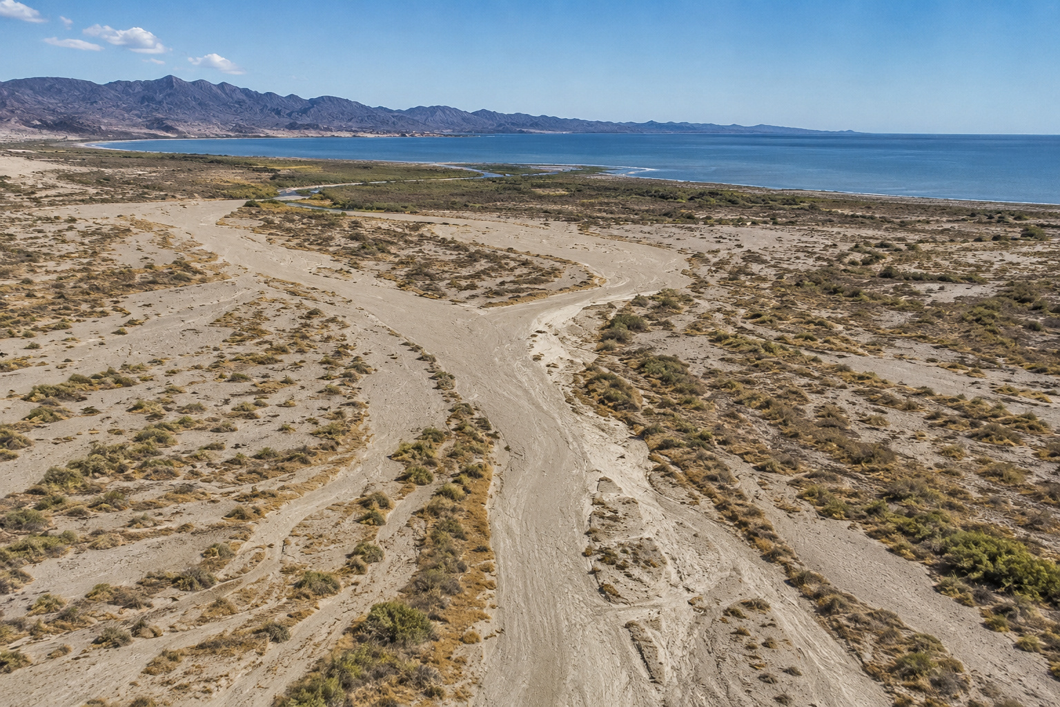
Desert mountains crowd the horizon. Creosote and palo verde replace spruce and fir. Irrigated farmland suddenly appears where water has been coaxed from the river. Backwaters disappear into cattails and reeds. Cottonwoods and willows form green ribbons against country that sometimes receives only a few inches of rain in an entire year.
And somewhere beneath all that brown desert and green vegetation are bass.
That last part gets my attention.
After spending much of my life fishing reservoirs, I've always enjoyed the puzzle presented by a river. Reservoir bass fishing is often about structure, depth and seasonal migration. River fishing adds another player to the game:
Current.
Current turns a point into a feeding station.
Current turns a fallen tree into an ambush point.
Current turns an opening into a backwater into a bass highway.
And nowhere does that become more apparent than along this stretch of the Colorado River between Parker and Yuma, particularly around Martinez Lake and the maze of backwaters above Imperial Dam.
For Paulette and me, this is also familiar winter country. From our place near Lake Mohave, we're following the same Colorado south through a landscape that becomes progressively warmer, flatter and more agricultural with every mile.
By the time we reach Yuma, winter has almost forgotten what winter is supposed to be.
I can live with that.
Leaving the Colorado River Parker Strip
Our journey begins where my Colorado River Parker Strip bass fishing chapter left us, below Parker Dam and the narrow recreational corridor around Parker, Arizona.
The Parker Strip taught us an important lower-river lesson: don't mistake narrow water for simple water.
Below Headgate Rock Dam, the character changes again.
The Colorado flows through the Colorado River Indian Reservation and toward increasingly agricultural country. Irrigation diversions become an important part of the river's story.
The surrounding landscape opens.
Backwaters appear.
Old river channels, marshes, ponds and oxbows create habitat dramatically different from the rocky smallmouth water farther upstream.
That means I begin changing tackle.
I still keep a spinning rod handy.
But now the heavier casting rods come out.
We're entering largemouth country.
The Colorado River Between Parker and Yuma
The distance by road from Parker to Yuma is roughly 115 miles, depending upon route and endpoints, but the river follows its own wandering course.
This portion of the lower Colorado passes through some fascinating country:
The Colorado River Indian Reservation.
Agricultural valleys.
Cibola Valley.
Cibola National Wildlife Refuge.
Imperial National Wildlife Refuge.
Martinez Lake.
Imperial Reservoir.
Imperial Dam.
And finally Yuma.
This isn't the canyon-bound Colorado of Utah or northern Arizona.
The river historically wandered across a broad floodplain here.
Before dams controlled it, seasonal snowmelt from hundreds of miles upstream could produce enormous floods.
That flooding created wetlands, refreshed backwaters, deposited fertile sediment and occasionally moved the river itself.
Today the system is heavily regulated.
But traces of the old river remain everywhere.
And many of those remnants are excellent fish habitat.
Water Levels: This Is an Operating River
One mistake visitors make on the lower Colorado is thinking of water levels the way they think about a conventional lake.
This is a working river.
Water is being stored.
Released.
Diverted.
Moved through irrigation systems.
Delivered to farms and communities.
Managed between dams.
The Bureau of Reclamation's current lower Colorado reports illustrate that perfectly. On August 26, 2026, for example, Martinez Lake stage was around 184.7 feet during the early morning while flow through that portion of the system was roughly 6,650 cubic feet per second. Farther downstream, flow measured at Yuma was much lower because major diversions occur before the river reaches the city. Those numbers change with operations, so they should be treated as a snapshot rather than a permanent condition. (USBR)
For fishermen, that's important.
Changing flow can reposition bass.
A current seam that produced yesterday may weaken today.
A backwater entrance may have more or less flow.
A shallow flat can become shallower.
Water clarity can change.
Floating debris can move.
My rule on the lower Colorado is the same one I use everywhere below a major dam:
Check current conditions before launching.
The Bureau of Reclamation publishes current lower Colorado river operations and stage information, which is much more useful than relying upon a water level somebody mentioned six months ago. (USBR)
What Feeds the Colorado River Between Parker and Yuma?
By this point in its journey, the Colorado no longer receives the parade of great tributaries we encountered upstream.
The Green River is far behind us.
So are the Gunnison, San Juan, Little Colorado and Virgin.
This is desert.
Natural tributaries tend to be intermittent washes rather than major perennial rivers.
The hydrology is increasingly dominated by the Colorado itself, irrigation returns, drainage channels, backwaters and dam operations.
That doesn't mean the washes are unimportant.
During a desert thunderstorm, a drainage that has been dry for months can suddenly deliver muddy runoff, debris and nutrients.
Those inflows can create temporary color changes and current.
And a fisherman should notice them.
Lakes and Backwaters Along This Colorado River Reach
Calling every body of water here a "lake" can be misleading.
Some are old river channels.
Some are backwaters.
Some are impoundments.
Some are connected directly or indirectly with the Colorado.
Among the important waters are:
Martinez Lake.
Ferguson Lake.
Clear Lake.
Island Lake.
Adobe Lake.
Imperial Reservoir.
Senator Wash Reservoir.
Numerous unnamed backwaters and marshes.
Imperial National Wildlife Refuge alone includes Martinez Lake at approximately 1,040 acres, Clear Lake at about 200 acres, Island Lake at roughly 2,010 acres and Adobe Lake at approximately 2,080 acres, along with lower Colorado River water. (U.S. Fish and Wildlife Service)
For a largemouth fisherman, that is an intriguing collection of possibilities.
Martinez Lake: A Bass Fisherman's Detour Worth Taking
If I were traveling from Parker to Yuma with a bass boat behind me, Martinez Lake would be one of the places I'd circle on the map before leaving home.
Martinez is part of the lower Colorado River backwater complex north of Yuma near Imperial Dam.
The U.S. Fish & Wildlife Service lists it at approximately 1,040 acres. (U.S. Fish and Wildlife Service)
It isn't a giant reservoir.
That's part of its charm.
Martinez Lake and the surrounding waterways offer a maze of:
Backwaters.
Reed lines.
Cattails.
Submerged vegetation.
Channels.
Docks.
Points.
Cuts.
Brush.
Marsh edges.
And connections with moving Colorado River water.
For somebody accustomed to fishing broad open reservoirs, Martinez feels intimate.
For somebody who likes largemouth bass?
It looks downright suspicious.
In a good way.
Imperial National Wildlife Refuge
Martinez Lake lies within one of the most important wildlife landscapes along this portion of the Colorado.
Imperial National Wildlife Refuge protects 25,768 acres and about 30 miles of lower Colorado River habitat. It was established in 1941 after Imperial Dam, completed in 1938, created extensive backwaters and marshes along the river. (U.S. Fish and Wildlife Service)
The refuge contains more than 15,000 acres of federally designated wilderness.
And here's a detail that fascinates me:
The Fish & Wildlife Service describes this stretch as including the last unchannelized section of the Colorado River before the river enters Mexico. (U.S. Fish and Wildlife Service)
That alone makes it worth seeing.
After following the Colorado through so many dams, diversions and engineered channels, finding a portion that still retains something of its old lower-river character feels important.
Wildlife Along the Lower Colorado
This is also prime camera country.
The refuge's backwaters, wetlands and river corridor support migratory birds, resident wildlife and threatened and endangered species. The contrast is extraordinary because summer temperatures can reach 120°F while annual rainfall averages only about two inches. (U.S. Fish and Wildlife Service)
Yet put Colorado River water into that desert and life explodes.
Paulette and I would be watching for:
Great blue herons.
Great egrets.
Snowy egrets.
Ospreys.
Bald eagles during winter.
Cormorants.
Pelicans.
Ducks.
Geese.
Grebes.
Coots.
Quail.
Coyotes.
Bobcats.
Desert bighorn sheep in suitable mountain country.
And reptiles that I prefer to photograph with a comfortable amount of real estate between us.
This country also lies along an important migratory corridor.
Some mornings I could probably be persuaded to put down the fishing rod and pick up the telephoto lens.
Probably.
Ancient People and the Colorado River at Yuma
The closer we get to Yuma, the more impossible it becomes to separate geography from human history.
People lived here long before Parker Dam, Imperial Dam, irrigation canals, Interstate 8 or the international boundary.
Ancestors of today's Quechan and Cocopah peoples lived along the lower Colorado and understood something travelers eventually learned themselves:
Yuma was one of the best places to cross the river.
The National Park Service explains that natural granite outcroppings narrowed and calmed the Colorado enough to create a practical crossing. Indigenous people discovered and used that crossing long before Europeans arrived. (National Park Service)
The Quechan relationship with this landscape goes far deeper than transportation.
The Fort Yuma Quechan Tribe describes its people as Kwatsáan, "those who descended," and their ancestral relationship with the lower Colorado River Valley reaches into creation traditions, sacred places, trails, geoglyphs and petroglyphs. (Fort Yuma Quechan Indian Tribe)
The modern Fort Yuma-Quechan Reservation lies along both sides of the Colorado River near Yuma and encompasses about 45,000 acres. (Fort Yuma Quechan Indian Tribe)
This wasn't empty desert waiting for history to arrive.
History was already here.
The Old Colorado Was a Very Different River
Before the great dams upstream, spring snowmelt could transform the lower Colorado.
Historical accounts describe a river that overflowed its banks and deposited enormous quantities of fertile silt.
The Quechan used those flood cycles for agriculture, planting crops in the rich floodplain soils. (National Park Service)
Imagine that Colorado for a moment.
No Hoover Dam.
No Glen Canyon Dam.
No Lake Mead.
No Lake Powell.
No carefully scheduled releases.
Snow melting in Wyoming, Colorado and Utah eventually became somebody's flood hundreds of miles downstream.
The river decided where the river went.
Modern water management changed that world almost beyond recognition.
But the backwaters around Martinez Lake give us a small glimpse of what lower Colorado habitat once looked like.
Yuma Crossing: Where Geography Became History
Spanish explorers reached the Yuma area in 1540.
Hernando de Alarcón navigated up the Colorado from the Gulf of California in support of Coronado's expedition. (National Park Service)
Later came missionaries, explorers and settlers.
Juan Bautista de Anza crossed here during his expedition toward California, aided by Quechan guides. (National Park Service)
Then came American expansion.
Gold seekers.
Ferries.
Military posts.
Steamboats.
Railroads.
Bridges.
Irrigation.
Highways.
The National Park Service notes that during the California Gold Rush, more than 60,000 travelers in one year crossed the Colorado at Yuma by rope ferry. (National Park Service)
Sixty thousand people.
In one year.
Standing there today, it's worth remembering what that must have looked like.
Wagons.
Livestock.
Dust.
Heat.
People who had traveled halfway across a continent staring at one last dangerous river before California.
I suspect there wasn't much complaining about poor Wi-Fi.
Yuma, Arizona
Modern Yuma occupies one of the most historically important locations on the lower Colorado.
Interstate 8 now crosses the river where generations once depended upon ferries and fords.
Agriculture dominates the surrounding valleys.
And the river that once flooded unpredictably is now carefully managed through dams and irrigation infrastructure.
The Yuma Crossing National Heritage Area preserves and interprets much of that history while also working to restore wetlands and reconnect the city with its riverfront. (National Park Service)
For a traveler following the Colorado from its headwaters, Yuma feels significant.
Mexico is close.
The river has almost completed its journey through the United States.
But before we get there, I've got some bass fishing to do.
Martinez Lake Largemouth Bass Fishing
The Fish & Wildlife Service lists largemouth bass among the species available within Imperial National Wildlife Refuge waters, along with smallmouth bass, striped bass, catfish, crappie, tilapia and several sunfish species. (U.S. Fish and Wildlife Service)
But Martinez Lake is the kind of water that makes me think primarily about largemouth.
Why?
Habitat.
Largemouth love choices.
And Martinez gives them plenty.
I look for combinations of:
Aquatic vegetation.
Cattails.
Reeds.
Brush.
Wood.
Docks.
Channel edges.
Backwater mouths.
Current breaks.
Shade.
And slightly deeper water nearby.
The best spot may contain three or four of those ingredients.
River Fishing Versus Lake Fishing
The most important distinction is still current.
On a conventional lake, I may find a submerged point and ask:
How deep is it?
Where's the drop?
Where are the fish?
On the Colorado River I ask another question first:
What is the water doing?
A backwater entrance may have bass because current brings forage past the opening.
A laydown may hold bass because its trunk creates a protected pocket.
A patch of reeds may be better on the downstream side because that's where slack water forms.
A dock piling may be valuable because current breaks around it.
River largemouth are opportunists.
They want food delivered without paying too much for it in energy.
I can relate.
Fishing the Main Colorado River
On the river itself, I concentrate on:
Current seams.
Eddies.
Riprap.
Wing structures where present and legal to fish.
Backwater mouths.
Rock.
Bridge-related structure where access and regulations permit.
Laydowns.
Docks.
Channel bends.
I often cast upstream or quartering upstream.
Then I allow the lure to move with the current.
That presentation looks natural because forage doesn't normally swim around pretending current doesn't exist.
Fishing Martinez Lake and Backwaters
Once inside Martinez Lake or a protected backwater, I shift gears.
Now vegetation becomes more important.
I slow down.
I start looking for:
Irregular reed edges.
Small points.
Cuts.
Pockets.
Isolated clumps.
Submerged grass.
Wood mixed with vegetation.
Docks adjacent to deeper channels.
Openings connecting two bodies of water.
One little indentation in a reed line can be better than 200 yards of straight vegetation.
Bass like edges.
They particularly like edges within edges.
Winter: December Through February
Winter is one of the most comfortable times for humans to visit Yuma.
Bass may disagree.
Cold fronts can slow largemouth, but desert sunshine can warm protected backwaters surprisingly quickly.
I begin with deeper water adjacent to cover.
My winter tackle includes:
A 7-foot medium spinning rod.
2500-size spinning reel.
8- to 10-pound braid.
8- to 10-pound fluorocarbon leader.
For casting tackle:
7-foot medium-heavy rod.
6.8:1 or 7.1:1 baitcaster.
12- to 15-pound fluorocarbon.
Favorite winter lures:
3- to 4-inch finesse worms.
Ned rigs.
Drop shots.
Small jigs.
Suspending jerkbaits.
Slow-rolled spinnerbaits.
Compact Texas rigs.
Colors stay natural:
Green pumpkin.
Watermelon.
Brown.
Smoke.
Shad.
Black-and-blue in stained water.
I slow down.
Winter bass are perfectly capable of eating.
They're simply less willing to chase my mistakes.
Spring: March Through May
Now Martinez Lake gets interesting.
Water temperatures rise.
Largemouth move toward protected spawning areas.
I start looking for shallow flats with:
Firm bottom.
Protected water.
Vegetation nearby.
Access to deeper water.
Warm afternoon sun.
Prespawn bass may stage on channel edges and the first substantial cover outside spawning pockets.
This is when I use:
3/8-ounce spinnerbaits.
3/8-ounce vibrating jigs.
4- to 5-inch soft jerkbaits.
Texas-rigged craws.
4- to 6-inch stick worms.
Compact jigs.
Squarebill crankbaits.
Once fish move onto beds, I slow everything down.
A Texas-rigged creature bait or small craw can be excellent.
White is useful for sight fishing because I can see the bait disappear.
When it disappears into a bass's mouth, the situation becomes fairly straightforward.
Summer: June Through September
Summer around Yuma isn't fooling around.
Imperial National Wildlife Refuge notes that temperatures can reach 120°F. (U.S. Fish and Wildlife Service)
That changes both fishing and safety.
I fish early.
Very early.
At first light, bass may be active around shallow vegetation.
Topwater can be excellent.
My choices:
Hollow-body frogs.
Buzzbaits.
Walking baits.
Poppers.
Soft-plastic frogs.
Then sunlight hits the water.
Bass move toward:
Shade.
Thicker vegetation.
Deeper channel edges.
Docks.
Matted cover.
Wood.
This is when flipping and pitching become important.
I switch to:
7'3" to 7'6" heavy casting rod.
High-speed baitcaster.
40- to 65-pound braid around heavy vegetation.
Texas-rigged creature bait.
1/2- to 1-ounce weight depending upon cover.
Summer isn't finesse season when I'm trying to pull a largemouth through a salad bar.
Fall: October and November
Fall may be my favorite all-around time.
The desert begins cooling.
Boat traffic eases.
Bass feed more aggressively.
Shad and other forage become important.
I look around:
Backwater mouths.
Current breaks.
Vegetation edges.
Channel intersections.
Riprap.
Wood.
Now I want moving baits again.
Spinnerbaits.
Vibrating jigs.
Squarebills.
Lipless crankbaits.
Swimbaits.
Topwaters early.
If bass are chasing forage, I cover water.
If they're not, I slow down with a worm or jig.
I don't try to convince fish they're doing something they aren't.
My Martinez Lake Largemouth Tackle
If I could bring only three outfits, I'd choose:
Finesse Spinning Outfit
Rod: 7-foot medium
Reel: 2500
Main line: 10-pound braid
Leader: 8- to 10-pound fluorocarbon
For drop shots, finesse worms, Ned rigs and light soft plastics.
General Casting Outfit
Rod: 7-foot medium-heavy
Reel: 7:1 baitcaster
Line: 12- to 17-pound fluorocarbon
For jigs, Texas rigs, spinnerbaits, vibrating jigs and crankbaits.
Heavy Vegetation Outfit
Rod: 7'3" to 7'6" heavy
Reel: 7.5:1 or faster baitcaster
Line: 40- to 65-pound braid
For frogs, heavy vegetation and pitching.
Those three cover most situations I'm likely to encounter.
Best Martinez Lake Lures
My tackle box would contain:
-
4- to 6-inch stick worms
-
6- to 8-inch Texas-rigged worms
-
3- to 4-inch creature baits
-
3/8- to 1/2-ounce jigs
-
3/8- to 1/2-ounce spinnerbaits
-
3/8- to 1/2-ounce vibrating jigs
-
Squarebill crankbaits
-
Lipless crankbaits
-
3- to 5-inch paddletail swimbaits
-
Hollow-body frogs
-
Walking topwaters
-
Poppers
-
Soft-plastic jerkbaits
Favorite colors:
Clear water: green pumpkin, watermelon, shad, translucent baitfish.
Stained water: black-and-blue, junebug, chartreuse-and-white, darker crawfish patterns.
Muddy water: black, black-and-blue and brighter moving baits with vibration.
Color matters.
But location matters more.
A perfect green-pumpkin worm cast where there isn't a bass remains a worm without employment.
How Deep Should I Fish Martinez Lake?
I don't begin with a magic number.
I begin with habitat.
During spring, bass may be extremely shallow.
In summer, some fish remain shallow beneath thick vegetation while others move toward deeper channels.
Winter bass often relate to deeper water near cover.
As a general framework:
1-5 feet: spawning areas, reeds, shallow vegetation, frogs and topwater.
5-10 feet: docks, grass edges, wood, secondary channels.
10-20+ feet: deeper channel edges, winter fish and offshore structure where available.
But the Colorado River system changes.
Electronics tell me what is there today.
Fishing Regulations and Seasonal Access
Imperial National Wildlife Refuge allows fishing year-round in most refuge waters, but there are important exceptions.
The western half of Martinez Lake and northern portion of Ferguson Lake are open to fishing only from March 1 through September 30.
The refuge also specifies that Martinez and Clear Lakes have bank-fishing provisions, while other waters may require boat access. (U.S. Fish and Wildlife Service)
Regulations can change, so I would check both current refuge rules and the appropriate Arizona or California fishing regulations before launching.
That five-minute check is cheaper than explaining your interpretation to a game warden.
Martinez Lake Records
This is one place where accuracy matters more to me than filling a heading with an impressive number.
I did not find a current authoritative Martinez-Lake-only largemouth record maintained by Arizona Game and Fish.
So I'm not going to manufacture one from fishing-forum folklore.
Arizona Game and Fish maintains official state and Colorado River record categories, but unless a record is explicitly identified as a Martinez Lake record, I would not present it as one.
That's the difference between a fishing story and a fishing guide.
Both have their place.
But only one should be used to plan a trip.
Catch and Release
A big lower Colorado largemouth deserves careful treatment.
In winter and spring:
Land it efficiently.
Wet my hands.
Support large fish properly.
Have the camera ready.
Take the photograph.
Release it.
Summer requires extra care.
Warm water carries less dissolved oxygen.
Hot boat carpet can damage a fish's protective slime coat.
Long photo sessions add stress.
If I'm fishing during extreme heat, I keep the fish in the water whenever practical and make the photograph quick.
I want somebody else to catch that bass.
Maybe me.
Preferably when she's two pounds heavier.
Martinez Lake Resort and Marina
Martinez Lake Resort provides lodging, docks and boating services in the Martinez Lake community.
The resort currently advertises annual, monthly and daily dock availability along with a courtesy dock. Its boat and UTV shop lists a phone number of 928-783-9589 and email info@martinezlake.com. (MLR main site)
Bungalows are also available, with the same telephone number used for lodging availability. (MLR main site)
For anybody towing a bass boat, I would call ahead.
Water conditions, dock availability and services can change.
Public Boat Access Near Imperial Dam
One excellent public option is T.K. Jones Campground and Boat Launch, operated by BLM.
It sits on Colorado River backwaters directly above Imperial Dam and includes approximately 125 RV sites, tent camping, a paved boat ramp with docks and a separate canoe/kayak launch. (Bureau of Land Management)
There are also restrooms, showers, potable water, trailer parking and day-use facilities.
BLM lists the Yuma Field Office contact number as 928-317-3200. (Bureau of Land Management)
That's the sort of facility I appreciate.
Back the trailer down.
Launch the boat.
Go fishing.
No expedition required.
Senator Wash
Nearby Senator Wash Reservoir provides another recreation opportunity with boating, fishing, camping and wildlife viewing.
One important detail:
The Senator Wash boat ramp does not provide boat access directly to the Colorado River. (Bureau of Land Management)
That's exactly the kind of detail worth knowing before arriving with a boat.
BLM maintains North Shore and South Shore camping areas, with shoreline access and a nearby boat ramp. (Bureau of Land Management)
Camping Near Martinez Lake and Imperial Dam
This stretch of the Colorado is remarkably friendly to campers.
Options include:
T.K. Jones Campground.
Senator Wash North Shore.
Senator Wash South Shore.
Imperial Dam Long Term Visitor Area.
Private facilities around Martinez Lake.
Imperial Dam LTVA encompasses roughly 3,500 acres and was created specifically to accommodate winter visitors while reducing impacts on surrounding desert. (Bureau of Land Management)
That tells you something about winter in Yuma.
People discover 70-degree sunshine in January and suddenly become reluctant to leave.
I understand the phenomenon.
Rafting, Kayaking and Paddling
This isn't Grand Canyon whitewater.
Recreation here is about exploring a broad lower-river ecosystem.
Kayaks and canoes can be wonderful tools for exploring backwaters where appropriate and permitted.
But current still deserves respect.
So does motorboat traffic.
In narrow channels, a kayak sits low enough to disappear against background vegetation.
I make myself visible.
I avoid primary boat routes when possible.
And when I'm operating the bass boat, I give paddlers plenty of room.
There's enough river for everybody.
Boating Safety on the Lower Colorado
The safety concerns change somewhat from the Parker Strip.
High-speed traffic remains possible, but now I add:
Shallow backwaters.
Submerged vegetation.
Unmarked obstructions.
Sandbars.
Changing channels.
Floating debris.
Narrow cuts.
Rapidly changing weather.
Extreme summer heat.
Arizona Game and Fish continues to emphasize life-jacket use, including through its 2026 boating-safety campaign. (Arizona Game & Fish Department)
My rules remain simple.
PFD on while underway.
Kill switch attached.
Navigation lights working.
Charts and electronics current.
Slow down in unfamiliar water.
Watch behind as well as ahead.
Never assume another operator sees me.
And no alcohol for whoever is operating the boat.
A bass boat is a wonderful fishing platform.
At speed, it's also a serious machine.
Treat it accordingly.
Desert Heat Is a Boating Hazard
Around Yuma, heat deserves its own safety category.
Summer temperatures can approach 120°F. (U.S. Fish and Wildlife Service)
That's not merely uncomfortable.
It's dangerous.
I carry more drinking water than I think we'll need.
Sun protection.
Hat.
Long sleeves.
Sunscreen.
Emergency water.
And I watch Paulette while she watches me.
Heat exhaustion can creep up on someone.
The best summer strategy is still:
Launch before sunrise.
Fish early.
Get off the water before the desert turns the boat into a skillet.
Weather Seasons From Parker to Yuma
Winter
Winter is glorious.
Cool nights.
Mild afternoons.
Low humidity.
Lots of sunshine.
Bass fishing may require finesse, but this is prime camping and wildlife-watching season.
Spring
Spring brings warming water and spawning bass.
March and April may be my favorite months.
Wildlife is active.
Desert vegetation occasionally blooms.
But wind can become strong.
Summer
Hot.
Then hotter.
Then somebody apparently leaves the oven door open.
Early fishing is mandatory for me.
Monsoon thunderstorms can also produce lightning, wind and flash flooding.
Fall
October begins the transition.
By November the desert becomes pleasant again.
Bass respond to cooling water.
Winter visitors begin arriving.
The lower Colorado starts feeling alive with people again.
Getting to Martinez Lake
From Yuma, the Fish & Wildlife Service directs visitors north on Arizona Highway 95 to Martinez Lake Road between mile markers 46 and 47, then west approximately 10 miles toward the refuge area. (U.S. Fish and Wildlife Service)
Imperial National Wildlife Refuge headquarters is at:
12812 N Wildlife Way
Yuma, Arizona 85365
Phone: 928-783-3371. (U.S. Fish and Wildlife Service)
Imperial National Wildlife Refuge visitor information
From Interstate 8, BLM recreation sites around Imperial Dam can also be reached using Fourth Avenue and Imperial County Road S-24. (Bureau of Land Management)
Five Stops Along Our Colorado River Journey
Anyone joining us here can start at the beginning with my Colorado River from the Rocky Mountain Headwaters to the Gulf of California, where I follow the entire river from its snowy birthplace toward Mexico. (Colorado River Guide)
Far upstream, Colorado River Headwaters to Grand Lake shows just how unlikely this desert river seems when you first meet it as cold mountain water in Rocky Mountain National Park. (Colorado River Guide)
Our Colorado River Lake Mohave chapter visits the clear-water reservoir that eventually became Paulette's and my favorite winter fishing country. (Colorado River Guide)
The Colorado River below Lake Mohave follows the river from Davis Dam into Bullhead City, Laughlin and the lower Colorado country. (Colorado River Guide)
And Colorado River Lake Havasu and London Bridge brings the journey into the desert reservoir immediately upstream of Parker Dam and the Parker Strip. (Colorado River Guide)
Those chapters make this Yuma stretch more meaningful.
We're not visiting an isolated desert river.
We're following the same water all the way from the Rockies.
A Colorado River Morning at Martinez Lake
If I could choose my Martinez Lake morning, I'd start before the sun.
Boat already fueled.
Batteries charged.
Rods rigged the night before.
Coffee in the truck.
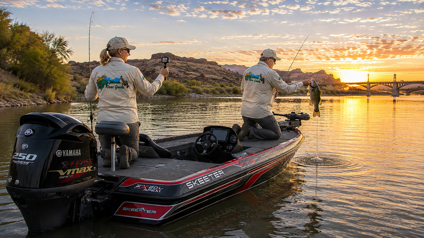
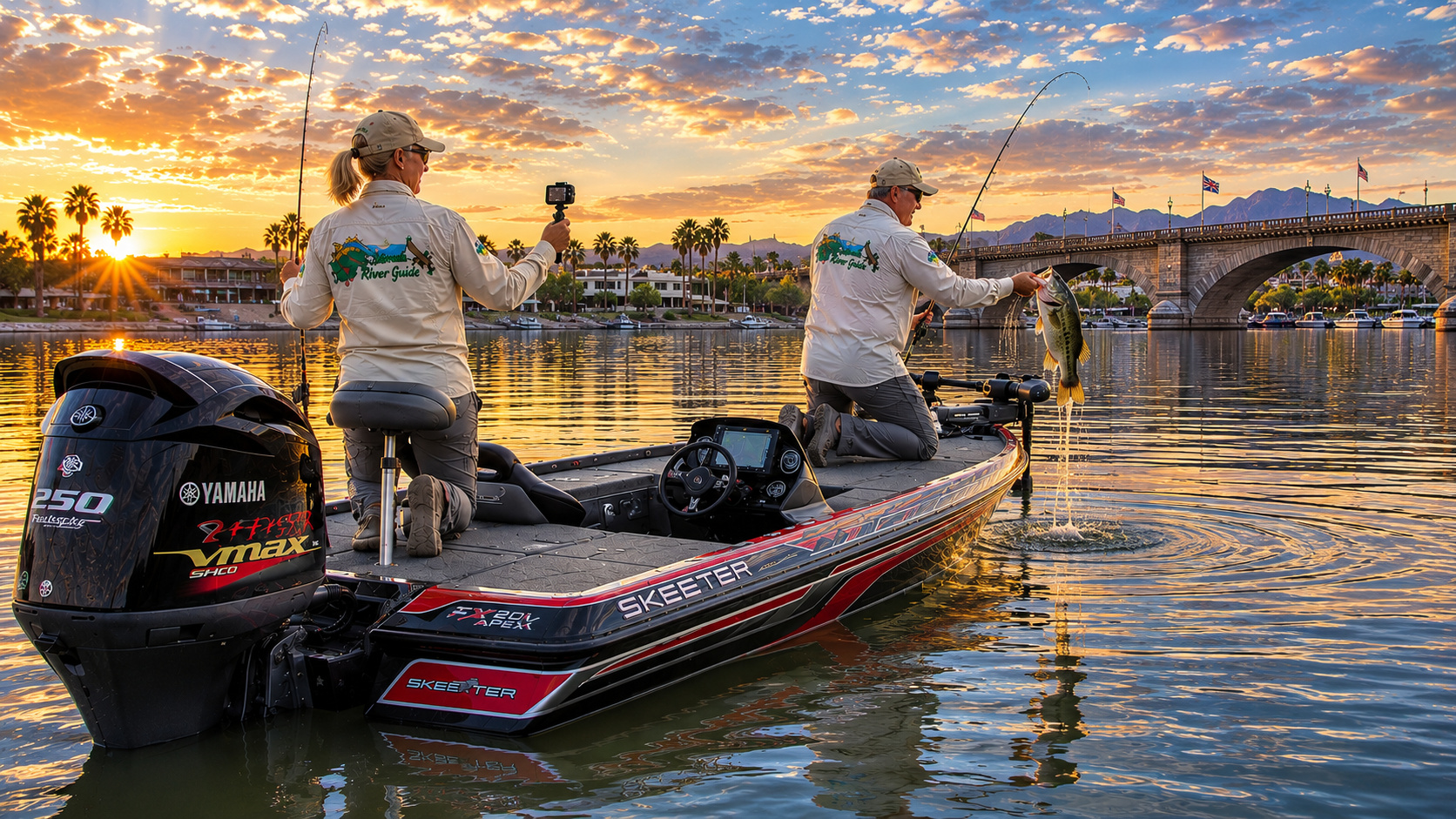
Paulette with her action camera and me pretending I haven't brought too much tackle.
We launch in the gray light before sunrise.
The Yamaha settles into its quiet idle.
I ease through the channel until we're clear.
Then the desert begins waking.
A great blue heron lifts from the reeds.
Quail call somewhere ashore.
The mountains catch the first orange sunlight while the water remains dark beneath them.
I shut down the Yamaha.
Trolling motor goes into the water.
Now we're fishing.
I start along a reed line.
Straight.
Straight.
Straight.
Then there's a little pocket.
Maybe six feet across.
Hardly anything.
But beside it is a submerged branch and a slight change in depth.
That's enough.
I pitch a green-pumpkin creature bait into the opening.
Nothing.
Second cast.
The line moves sideways.
Not much.
Maybe three inches.
But I've spent too many years watching fishing line to negotiate with three inches.
I set the hook.
The water erupts.
Largemouth.
Good one.
She dives into the vegetation.
The heavy rod bows.
Braid cuts through the grass.
For a moment nothing moves.
Then she comes free.
Paulette already has the camera.
Of course she does.
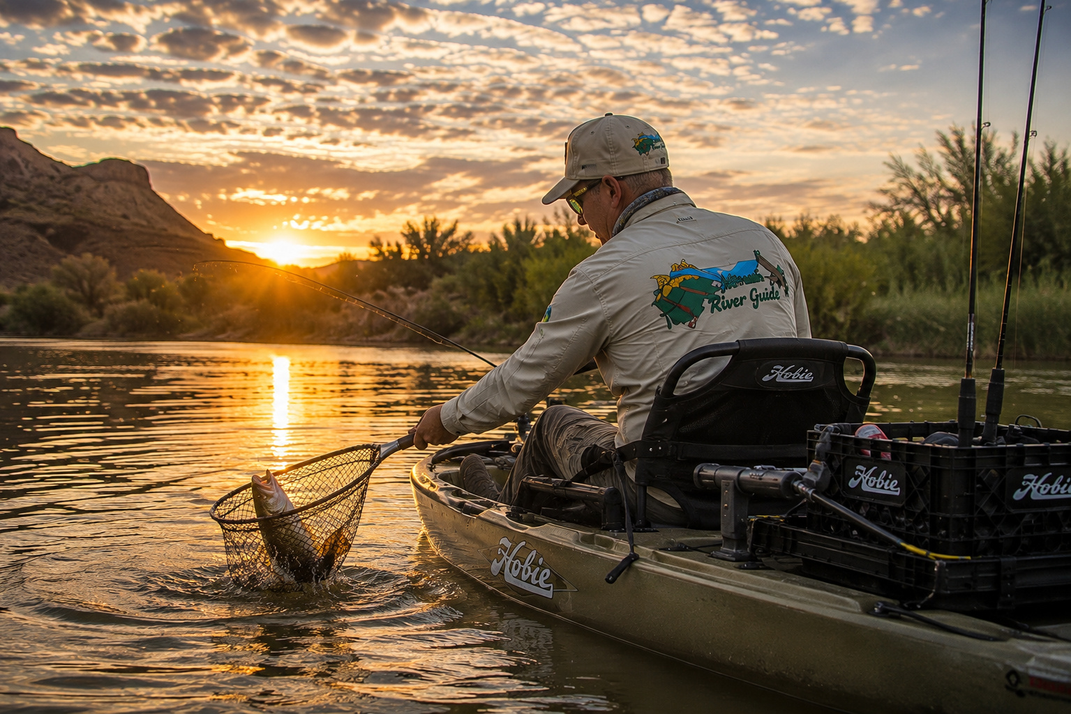
I bring the fish alongside, kneel at the front deck and lip her while her tail is still in the water.
Photograph.
Maybe ten seconds.
Then she goes back.
She hangs beneath my hand for a moment.
One kick.
Gone.
That's enough.
No cheering crowd.
No tournament weigh-in.
No trophy on the wall.
Just a bass swimming back beneath the reeds and two old fishermen smiling at each other in the Arizona sunrise.
I've had plenty of fishing days more complicated than that.
I'm not sure I've had many better ones.
When the Colorado Reaches Yuma
By the time our journey reaches Yuma, the river has traveled an almost unimaginable distance.
I think about where we've been.
Rocky Mountain National Park.
Grand Lake.
Granby.
Kremmling.
Glenwood Canyon.
Grand Junction.
Moab.
Canyonlands.
Lake Powell.
Lees Ferry.
Grand Canyon.
Lake Mead.
Lake Mohave.
Topock Gorge.
Lake Havasu.
Parker.
Martinez Lake.
Now Yuma.
A snowflake that fell in the Colorado Rockies has traveled through some of the most spectacular country on Earth.
But Yuma represents something more.
For thousands of years, people gathered here because of the river.
The Quechan understood it.
Spanish explorers understood it.
Settlers understood it.
Gold seekers understood it.
Farmers understood it.
Modern cities understand it.
Water is life in the Southwest.
That's easy to say.
Follow the Colorado for a thousand miles and you begin to understand what it actually means.
Around Martinez Lake, the lesson is visible from the boat.
Look east or west.
Desert.
Rock.
Creosote.
Heat.
Then look at the river.
Reeds.
Willows.
Fish.
Birds.
Wetlands.
Agriculture.
People.
Life.
The Colorado created that difference.
And now, standing at Yuma, we've almost reached the international boundary.
Mexico lies ahead.
So does one of the most complicated and poignant chapters in the entire Colorado River story.
The river that once reached the Gulf of California with enormous seasonal floods has been divided, stored, diverted and used again and again.
But it isn't finished yet.
Neither are we.
We'll keep following it south.
0 Comments