There are places I visit because they're beautiful.
There are places I visit because they're historic.
And then there are places that reach considerably farther back into my life, places that somehow seem familiar before I ever set foot in them.
For me, the Colorado River country between Grand Junction, Colorado, and Moab, Utah, is one of those places.
I suppose Hollywood deserves some of the blame.
Long before I carried cameras and telephoto lenses through the Southwest, long before Paulette and I began spending our retirement years wandering its mountains, rivers and deserts, and certainly long before I imagined writing my way down the Colorado River, I was a Kansas ranch boy watching Westerns.
Those movies planted something.
A rider beneath a towering red cliff.
A cavalry column raising dust across the desert.
A wagon train winding through country that seemed to stretch all the way to tomorrow.
John Wayne riding beside a river.
Ben Johnson sitting a horse the way only a real cowboy could.
Those pictures weren't merely entertainment to me.
They were windows.
And through those windows I first saw the Southwest.
Now, many decades later, I can drive Utah Highway 128 beside the Colorado River, look across Professor Valley toward Fisher Towers and the La Sal Mountains, and realize that I'm standing inside some of those old pictures.
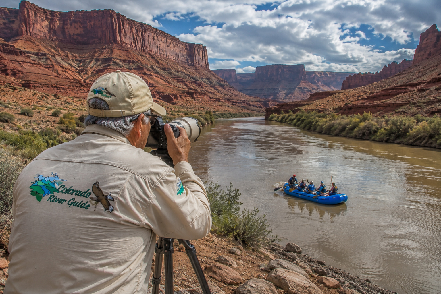
For an octogenarian who still carries a little Kansas cowboy country around inside him and rarely travels without a camera, this stretch of the Colorado River is something close to heaven.
Or perhaps a candy store.
An old cowboy photographer's candy store.
And I want to photograph everything.
Leaving Grand Junction With the Colorado River
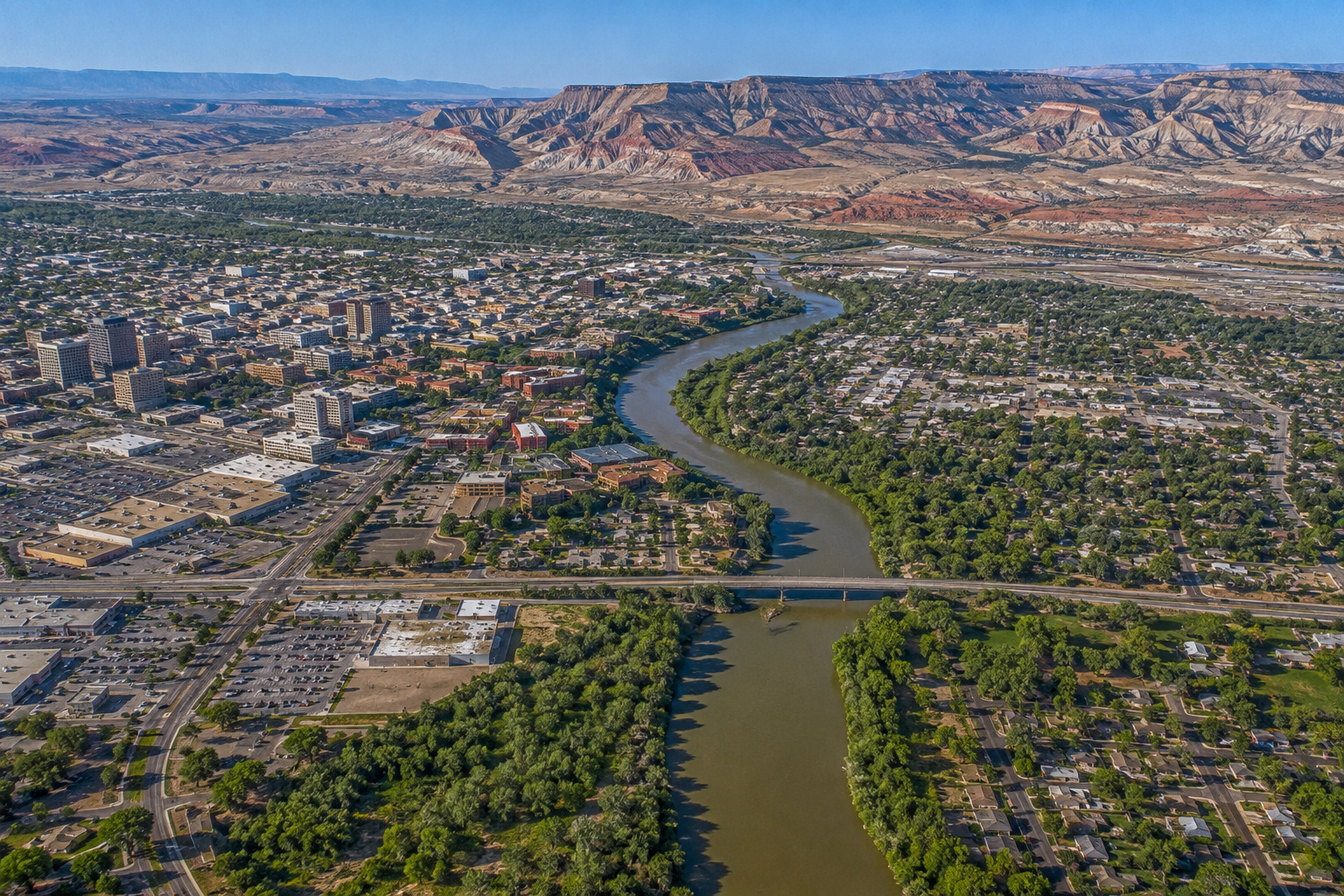
Our last chapter ended at Grand Junction, where the Gunnison River joins the Colorado River.
That confluence is important.
The Colorado arriving from the east has already collected water from an enormous mountain watershed. The Gunnison adds another major Rocky Mountain drainage, including water originating in the Elk, Sawatch and San Juan country.
Below Grand Junction, the river is bigger.
Broader.
Warmer.
And increasingly a desert river.
We follow Interstate 70 west through the Grand Valley toward Fruita and the Utah state line.
Behind us are the high mountains.
Ahead, the country opens into broad desert benches, sandstone cliffs and the northern reaches of the Colorado Plateau.
The transformation we've been watching since Glenwood Canyon is now unmistakable.
The Colorado River has left the Rockies.
We're entering red-rock country.
From Colorado Into Utah
West of Grand Junction, Interstate 70 and the Colorado River continue generally toward the Utah line, although they don't remain shoulder-to-shoulder everywhere.
This is open country.
The Book Cliffs dominate the northern horizon.
Cottonwoods and tamarisk mark watercourses.
Desert vegetation replaces mountain forest.
And the colors change.
Gray-green sage.
Buff sandstone.
Red cliffs.
Blue sky.
Then, depending upon the hour, everything turns gold.
For a photographer, the first and last hours of daylight become almost unfair.
Low sunlight rakes across sandstone and reveals textures that disappear at noon.
Every ridge casts a shadow.
Every crack gains depth.
Every cliff seems to glow from within.
This is when I start looking for a place to pull over.
Paulette knows the drill.
The Colorado River and Ancient People
Of course, neither Hollywood nor modern travelers discovered this country.
People have lived throughout the Colorado Plateau for thousands of years.
Archaeological evidence throughout southeastern Utah documents generations of Indigenous occupation and use. Ancestral Puebloan and Fremont peoples farmed where dependable water and arable soil allowed it, while also hunting and gathering from the surrounding landscape. Later Ute and Paiute peoples maintained their own deep relationships with this country. National Park Service interpretation in Canyonlands describes Ancestral Puebloan and Fremont communities using productive drainages for water, farmland, wild plants, deer and bighorn sheep. (National Park Service)
That relationship makes perfect sense when you're standing in this desert.
Water determines everything.
Where there is water, there are cottonwoods.
Where there are cottonwoods, there is shade.
Wildlife comes to drink.
Plants grow.
People can live.
The Colorado River wasn't a scenic attraction to ancient people.
It was part of the foundation of life.
That's something worth remembering as we follow it with air-conditioned vehicles, digital cameras and coolers full of bottled water.
Our own Colorado River fly-fishing journey touches on that same relationship between people, water and the changing landscapes of the Southwest. (Colorado River Guide)
The Colorado River Near the Utah State Line
By the time the river crosses into Utah, its fishery is changing too.
The cold-water trout river of Kremmling and Glenwood Canyon is behind us.
Near Grand Junction and downstream into Utah, warmer water favors a mixture of native and introduced warmwater fish.
This distinction is important because the Colorado River basin contains endangered native fishes that anglers must recognize and protect.
Utah's current 2026 fishing regulations specifically address the Colorado River from the Colorado state line downstream. Regulations are designed partly to reduce populations of certain nonnative predators that threaten native fish. The current Utah guidebook should always be checked before fishing because rules can change. (Utah Wildlife)
The old rule still applies:
Know what you've caught before deciding what to do with it.
The Dolores River Joins the Colorado
One of the major feeder tributaries on this journey is the Dolores River.
The Dolores begins high in southwestern Colorado's San Juan Mountains and travels through some magnificent canyon country before joining the Colorado upstream of Moab.
This is a substantial tributary with a watershed of its own.
By the time we reach the confluence, the Colorado has gathered water from an astonishing family tree:
the Fraser,
Blue,
Eagle,
Roaring Fork,
Gunnison,
Dolores,
and dozens upon dozens of smaller creeks, washes and drainages.
Some flow year-round.
Others wake dramatically after a desert thunderstorm.
Every one eventually points downhill.
And the Colorado collects the bill.
Colorado River Water Levels
River levels between Grand Junction and Moab vary tremendously by season and water year.
Spring snowmelt from the Rocky Mountains traditionally produces the highest sustained flows.
Late summer and autumn usually bring lower water.
Winter generally brings relatively stable lower flows, although reservoir operations, tributary inflows and weather can change conditions.
The USGS Colorado River gauge near Cisco, Utah, is an especially useful reference for this stretch.
I don't recommend putting a fixed flow figure into a permanent trip plan because Colorado River discharge can change substantially.
Before fishing, rafting or launching a boat, I check the current USGS gauge.
Yesterday's river isn't necessarily today's river.
That lesson becomes particularly important in desert country.
A distant thunderstorm can turn an innocent-looking wash into moving chocolate milk surprisingly quickly.
Lakes and Reservoirs Affecting the River
There are no giant main-stem reservoirs between Grand Junction and Moab, which is one reason this section feels so wonderfully like a river.
But upstream reservoirs strongly influence Colorado River hydrology.
Among them are:
Lake Granby on the upper Colorado River system, Dillon and Green Mountain reservoirs in the Blue River watershed, Ruedi Reservoir in the Roaring Fork system, and Blue Mesa, Morrow Point and Crystal reservoirs on the Gunnison.
Far downstream, of course, the Colorado will encounter enormous reservoirs including Lake Powell, Lake Mead and Lake Mohave.
For now, however, it runs free through the desert.
And I'm glad it does.
Cisco Utah and the Turn Toward Highway 128
Near the old community of Cisco, we leave Interstate 70 and turn onto Utah State Route 128.
This is where I would tell any photographer:
Slow down.
Whatever schedule you had, forget it.
Highway 128 follows the Colorado River southwest toward Moab through one of the great scenic corridors of the Southwest.
UDOT officially identifies the route as the Upper Colorado River Scenic Byway. The byway follows the river past Dewey Bridge, Hittle Bottom, Fisher Towers, Professor Valley, Onion Creek, Castle Valley and Big Bend before reaching Moab. (UDOT Open Data)
This road is only pavement.
But what surrounds it is cinema.
Dewey Suspension Bridge
One of our first landmarks is Dewey Bridge.
The historic Dewey Suspension Bridge once carried highway traffic across the Colorado River.
Today the remains of the old bridge survive near the BLM recreation site, where travelers can camp, fish, launch small boats and explore the river corridor.
The BLM's current Dewey Bridge Recreation Site has individual and group camping, toilets and small-boat river access, but no potable water or hookups. (Bureau of Land Management)
I like places like Dewey.
An old bridge beside an old river.
Sandstone bluffs catching evening light.
Cottonwoods rustling along the bank.
And enough history to make me wonder who crossed here before me.
That's dangerous country for a photographer.
I can lose an hour without moving fifty yards.
Highway 128: My Kind of Road
From Dewey Bridge south, Highway 128 begins delivering one scene after another.
The Colorado twists between increasingly dramatic sandstone formations.
Fisher Towers rise above the landscape.
The La Sal Mountains appear beyond the red rock, sometimes snow-covered while the desert below is warm.
Castle Valley opens to the south.
Professor Valley stretches beside the river.
And suddenly I begin recognizing places.
Not because I've necessarily stood there before.
Because I've seen them on a screen.
Where My Southwest Was Born
This is the part of the journey that reaches back into my boyhood.
Wagon Master.
Rio Grande.
Taza, Son of Cochise.
Warlock.
The Comancheros.
Rio Conchos.
Then, from later years:
Geronimo: An American Legend.
City Slickers II: The Legend of Curly's Gold.
And now Horizon: An American Saga.
These weren't all filmed exclusively along Highway 128, of course, and individual productions used multiple locations throughout southeastern Utah and elsewhere.
But this Colorado River and Professor Valley country appears again and again.
Moab's official film-location history identifies Wagon Master locations in Professor Valley, along the Colorado River and in Spanish Valley. John Ford's Rio Grande used White's Ranch, Professor Valley, the Colorado River and Onion Creek Narrows. Taza, Son of Cochise used White's Ranch, Castle Valley and Professor Valley. (Discover Moab)
Warlock used Professor Valley, Dead Horse Point, King's Bottom, White's Ranch, Arches and Sand Flats. The Comancheros used Professor Valley, Dead Horse Point, the La Sal Mountains, Fisher Valley and Onion Creek. Rio Conchos returned to White's Ranch, Castle Valley and Professor Valley. (Discover Moab)
Decades later, Geronimo: An American Legend used Professor Valley and other Moab-area locations, while City Slickers II used Dugout Ranch, Fisher Towers and Onion Creek. (Discover Moab)
And the tradition continues. Production information for Horizon: An American Saga confirms that the production filmed in the Moab region as part of its extensive Utah location work. (Irving Chamber)
I can stand beside the Colorado River today, camera in hand, and look across landscapes where filmmakers were setting up cameras three-quarters of a century ago.
That means something to me.
Wagon Master and John Ford
John Ford's Wagon Master, released in 1950, helped establish the Moab country as a major Western filming location.
Professor Valley and the Colorado River provided the landscapes.
Ford reportedly regarded Wagon Master as one of the films that came closest to what he had hoped to achieve.
And I understand why he loved this country.
A cinematographer hardly needs to build a set.
Put a horseman beneath Fisher Towers.
Point the camera.
The landscape has already done most of the work.
The Utah Geological Survey credits Wagon Master with helping open Hollywood's eyes to Moab as a Western filming landscape beyond the already-famous Monument Valley. (AFI Catalog)
Rio Grande: A River Playing Another River
Then came Rio Grande.
There is something wonderfully appropriate about our Colorado River journey encountering a movie called Rio Grande that used the Colorado River as part of its scenery.
John Wayne.
Maureen O'Hara.
Ben Johnson.
Victor McLaglen.
The Sons of the Pioneers.
Cavalry horses beneath towering red cliffs.
The movie used the Colorado River, Professor Valley, White's Ranch and Onion Creek country around Moab. (IMDb)
Watching it as a boy, I wasn't studying geography.
I simply knew I wanted to see country like that someday.
Turns out I did.
Red Cliffs Lodge and White's Ranch
At approximately Mile 14 on Highway 128 we reach Red Cliffs Lodge.
This is more than a convenient place to stay beside the Colorado River.
Historically, the property was White's Ranch, one of the recurring filming locations of Moab's Western era.
Today the lodge sits directly beneath tremendous red cliffs along the Colorado River and operates the Moab Museum of Film & Western Heritage.
The museum preserves memorabilia, costumes and stories from the long history of filmmaking around Moab. Current lodge information says admission is included for overnight guests and is $15 for the general public. (Red Cliff Lodge)
I could spend some time there.
Quite a bit of time.
Paulette might eventually have to come looking for me.
Professor Valley: The Candy Store Opens
Professor Valley is where the title of this story really earns its keep.
This is an old cowboy photographer's candy store.
Red cliffs.
Cottonwoods.
Open desert.
Castle Rock.
Fisher Towers.
The La Sal Mountains.
The Colorado River.
Old ranch country.
Horseback riders.
Cloud shadows traveling across sandstone.
I wouldn't know where to point the camera first.
Actually, that's not true.
I'd point it everywhere.
Early morning would find me watching sunlight creep down the cliffs.
Late afternoon would find me waiting for the rock to turn orange and red.
Sunset would find me looking for silhouettes.
And somewhere during the day I would inevitably stop beside a place where John Wayne once rode through a movie frame.
Lower Onion Creek Campground
Farther along Highway 128, the BLM's Lower Onion Creek Campground puts us directly beside the Colorado River with views toward Fisher Towers and surrounding red-rock formations.
The campground currently has 21 individual sites, group sites, toilets and two boat ramps. There is no potable water or utility hookup. Individual sites are first-come, first-served, while group sites can be reserved. (Bureau of Land Management)
This is serious desert camping.
Bring water.
Then bring more water.
Shade is precious.
And during summer, heat isn't a minor inconvenience.
It's part of trip planning.
The Colorado Riverway Recreation Area
The BLM-managed Colorado Riverway along Highway 128 provides an extraordinary string of recreation opportunities.
There are campgrounds, boat ramps, trails, picnic areas and river-access points all along the corridor.
The BLM corridor map identifies sites including Dewey Bridge, Hittle Bottom, Lower and Upper Onion Creek, Big Bend, Hal Canyon, Goose Island and others. (Bureau of Land Management)
For a traveler following the Colorado River, this is ideal.
You don't merely see the river through a windshield.
You can stop.
Camp beside it.
Launch a boat.
Fish.
Photograph it.
Listen to it after dark.
Rafting the Moab Daily
The popular stretch commonly called the Moab Daily offers one of the most accessible Colorado River rafting experiences around Moab.
Unlike the ferocious whitewater we encountered in Gore Canyon, this is generally a friendlier river trip, with stretches of calm water mixed with manageable rapids depending upon flow.
BLM describes the Dewey Bridge-to-Hittle Bottom reach as roughly 7.5 miles of largely flat water, while downstream portions offer the classic Moab Daily rafting experience. (Bureau of Land Management)
For families and first-time rafters, commercial outfitters make this a practical way to experience the canyon from river level.
And river level changes everything.
Those cliffs that look impressive from Highway 128 become enormous when you're sitting in a raft beneath them.
Big Bend Campground
Closer to Moab is Big Bend Recreation Site, about 7.4 miles east of the Highway 191 junction.
Big Bend provides camping, a sandy beach, boat launch, picnic facilities and direct access to the Colorado River.
BLM specifically identifies it as a base for rafting the Moab Daily. (Bureau of Land Management)
This would be a fine base for a photographer.
Morning light.
Evening light.
River access.
Red cliffs.
And Moab only about half an hour away.
I could tolerate that hardship.
Hal Canyon Campground
Hal Canyon Campground lies even closer to Moab, about 6.6 miles east of the Highway 191 junction.
BLM currently lists 11 individual sites, including walk-in camping, with toilets but no water or hookups.
The campground sits right along the Colorado River canyon. (Bureau of Land Management)
This is simple camping.
Tent.
Sleeping bag.
Coffee.
Camera.
River.
Sometimes civilization improves considerably when you remove most of it.
Fishing the Colorado River Near Moab
By the time we reach Moab, I have changed tackle.
This isn't the cold trout water we fished around Granby and Kremmling.
The Utah Colorado River supports warmwater species and important native fishes.
Depending upon season and location, anglers may encounter channel catfish, carp and smallmouth bass, along with native species including roundtail chub and protected threatened or endangered Colorado River fishes.
Utah's 2026 regulations deserve careful attention. Certain nonnative species, including smallmouth bass, are subject to mandatory removal rules in the Colorado River system because of their impact on native fish. Threatened or endangered native fish must be immediately released. (Utah Wildlife)
For warmwater fishing, I'd carry a medium spinning outfit with 8- to 12-pound line.
For smallmouth, where legal and under current harvest regulations, crankbaits, tube jigs, grubs and small swimbaits can cover rocky habitat.
For channel catfish, appropriate natural baits fished near deeper holes and slower current can be productive.
But I would check the current Utah DWR guide before every trip.
This is a river where conservation regulations matter enormously.
Wildlife Along Highway 128
Fishing isn't likely to keep my camera packed away for long.
This country supports an impressive variety of desert wildlife.
I watch for desert bighorn sheep, mule deer, coyotes, bobcats, beaver and river-associated mammals, along with golden eagles, bald eagles seasonally, red-tailed hawks, peregrine falcons, ravens, great blue herons and waterfowl.
Bighorn sheep are particularly suited to the cliffs and broken rock around the Colorado River canyon.
They're also remarkably difficult to see when they don't move.
A ram can stand against a cliff looking approximately like another piece of sandstone until he turns his head.
That's where binoculars earn their place in the truck.
Weather: Four Very Different Deserts
Spring
Spring is one of my favorite seasons.
Days can be mild.
Desert plants begin waking.
Snow may still crown the La Sal Mountains.
The Colorado rises as Rocky Mountain snowmelt works downstream.
Photographic light is excellent, but wind can be persistent.
Summer
Summer is hot.
Not "perhaps I'll bring another shirt" hot.
Desert hot.
Midday hiking requires caution, abundant water and common sense.
Early morning becomes precious.
So does evening.
Monsoon-season thunderstorms can produce spectacular clouds and dangerous flash floods.
Never camp in a dry wash simply because it is dry when you arrive.
Fall
Fall may be nearly perfect.
Temperatures moderate.
Cottonwoods along the Colorado turn yellow.
The red cliffs deepen in late-afternoon light.
Crowds may ease somewhat after peak summer.
If I were planning a photography trip specifically for Highway 128, autumn would be high on my list.
Winter
Winter brings cold nights and occasional snow.
And when snow lands on red sandstone beneath blue sky, I want a camera.
Immediately.
The La Sal Mountains become especially beautiful.
The desert grows quiet.
Low winter sunlight gives the landscape long shadows all day.
Getting From Grand Junction to Moab
There are two ways to think about this drive.
The practical way and my way.
The practical route from Grand Junction follows Interstate 70 west across the Utah line, then continues toward Crescent Junction and takes U.S. Highway 191 south to Moab.
That is the efficient route.
But we're following the Colorado River.
So near Cisco, I want Utah Highway 128.
Highway 128 carries us southwest beside the Colorado through Dewey Bridge, Professor Valley, Fisher Towers country, Onion Creek, Red Cliffs Lodge and Big Bend before entering Moab.
It is slower.
Good.
That's the point.
If I'm driving Highway 128 quickly, I'm doing it wrong.
Moab Utah
Eventually those towering canyon walls escort us into Moab.
Modern Moab is an outdoor recreation crossroads.
Arches National Park lies just north.
Canyonlands National Park spreads west and south.
The Colorado River passes beside town.
Mountain bikers, climbers, rafters, photographers, hikers and four-wheel-drive enthusiasts all converge here.
But beneath all that modern recreation, I still see the old Western movie town.
Maybe that's because I'm looking for it.
An Old Cowboy Photographer's Candy Store
I sometimes wonder what that Kansas ranch boy would think if I could sit beside him during one of those old Westerns and tell him:
Someday you're going there.
Someday you'll stand beside that river.
You'll drive through Professor Valley.
You'll see Fisher Towers glowing at sunset.
You'll photograph those cliffs.
You'll walk through the country where John Wayne, Ben Johnson, Maureen O'Hara, Rock Hudson, Henry Fonda, Anthony Quinn and generations of Western actors once worked.
You'll grow old, but you won't outgrow the feeling those landscapes gave you.
I suspect that boy would have had trouble believing me.
But here I am.
More than eight decades of life behind me.
Paulette beside me.
Camera on the tripod.
Telephoto lens mounted.
The Colorado River moving quietly below.
Fisher Towers catching the last light.
The La Sal Mountains turning blue in the distance.
And somewhere in my memory, a cavalry troop is riding through the dust.
That's why I call this country an old cowboy photographer's candy store.
Not because there are endless things to photograph.
Although there certainly are.
It's because every photograph seems connected to something.
History.
Childhood.
Movies.
Ranch country.
Native people.
Western settlement.
The Colorado River.
The American Southwest.
Places like this remind me that our memories don't always live entirely in the past.
Sometimes we can drive down an old highway and find them waiting beside the road.
The Colorado River Keeps Calling Us West
We've come a long way since that little mountain stream in Rocky Mountain National Park.
The Colorado River has carried us through Grand Lake.
Granby.
Kremmling.
Gore Canyon.
Glenwood Canyon.
Grand Junction.
And now Moab.
The river that began among alpine meadows is flowing beneath red sandstone cliffs.
Trout water has become warmwater fish habitat.
Spruce and fir have given way to juniper and desert brush.
Snow-covered mountains have become sandstone towers.
And the river is only getting started.
Downstream lie Canyonlands.
The Green River confluence.
Cataract Canyon.
Lake Powell.
Glen Canyon.
Grand Canyon.
Lake Mead.
Lake Mohave.
For a glimpse of where this same river eventually takes us, wander ahead to my Colorado River Davis Dam and Lake Mohave guide, spend some time at Colorado River Davis Camp in Bullhead City, or walk the Colorado River Heritage Trail at Lake Mohave.
Those three articles, together with the earlier fly fishing the Colorado River article and Colorado River movie-country history, give us five natural internal paths into the growing Colorado River Guide story.
But I'm not ready to leave Moab.
Not yet.
The sun is getting low.
Those red cliffs are beginning to glow.
I've got another memory card in the camera.
And an old cowboy photographer can always find room for one more piece of candy.


0 Comments