Colorado River Dotsero to Grand Junction Colorado: Through Glenwood Canyon and the Grand Valley
There are stretches of the Colorado River where the river seems to follow the road.
Then there is Glenwood Canyon, where the river, railroad and Interstate 70 all appear to have been told there is only one way through the mountains and they'd better learn to get along.
Standing near Dotsero, Colorado, I can almost feel our Colorado River journey changing gears.
Behind us are the high Rocky Mountain headwaters, Grand Lake, Lake Granby, Middle Park, Kremmling, Gore Canyon, Pumphouse, Radium and State Bridge.
Ahead of us lies an entirely different Colorado River.
The mountains tighten around the water at Glenwood Canyon.
Whitewater boils through Shoshone.
The Roaring Fork River joins us at Glenwood Springs.
Then the canyon releases its grip.
The country begins opening.
Cottonwoods line the river.
Ranches and towns appear.
Interstate 70 follows alongside.
The river passes New Castle, Silt, Rifle, Parachute, De Beque and Palisade.
Finally we enter the broad Grand Valley and Grand Junction, where the Gunnison River joins the Colorado and our river becomes substantially larger once again.
For an old fellow who grew up on cattle ranches in the Kansas Flint Hills, there is something familiar about watching a mountain river gradually enter ranching and agricultural country.
The mountains are still there.
But the land is opening.
And so is the river.
Let's leave Dotsero and follow the Colorado River to Grand Junction.
Dotsero: Where the Eagle River Joins the Colorado
Dotsero isn't a large town.
Geographically, however, it sits in an important place.
Here the Eagle River joins the Colorado River.
The Eagle begins high in the central Rocky Mountains and drains mountain country around Vail, Avon, Eagle and Gypsum before entering the Colorado.
That additional water helps transform the Colorado before it enters Glenwood Canyon.
Dotsero is also where Interstate 70 joins our river journey in earnest.
The interstate, railroad and Colorado River now head west together.
BLM's Ute Trail Trailhead at Dotsero sits near the confluence of the Colorado and Eagle rivers and provides another reminder that people were traveling through this country long before Interstate 70 appeared. (Bureau of Land Management)
And then the walls begin closing in.
Glenwood Canyon: The Colorado River Builds Its Own Highway
Glenwood Canyon stretches roughly 16 miles between Dotsero and Glenwood Springs.
Calling it impressive doesn't quite cover it.
The Colorado River has spent millions of years carving its way through layers of rock, creating a narrow passage with walls rising dramatically above the river.
The geology includes ancient rocks along with younger sedimentary formations, and groundwater working through limestone helped create extensive caves in the surrounding mountains.
But what always catches my attention is the basic geometry of the place.
River on the bottom.
Railroad beside it.
Interstate above and around both.
Mountain walls everywhere else.
When Interstate 70 through Glenwood Canyon was finally completed in 1992, engineers had accomplished something remarkable: placing a major interstate highway through an extraordinarily narrow natural canyon while trying to preserve the river and surrounding landscape.
There are elevated highway sections.
Retaining walls.
Tunnels.
Bridges.
Rest areas.
A recreation path.
And below all of it, the Colorado River keeps doing what it was doing long before engineers arrived.
Moving downhill.
Interstate 70 and the Colorado River
For much of the journey between Dotsero and Grand Junction, Interstate 70 becomes our traveling companion.
That's both convenient and unusual.
You can leave the interstate at numerous exits, find river access, fish, launch a boat, watch rafters, photograph wildlife or simply sit beside the Colorado for a while.
Then you're back on I-70.
In Glenwood Canyon, however, the highway itself becomes part of the scenery.
The road has been engineered so carefully into the canyon that in places the eastbound and westbound lanes occupy different elevations.
I have spent enough years around construction to appreciate what went into building something like this.
Every retaining wall, bridge pier and tunnel had to coexist with an active railroad, a major Western river and canyon walls that weren't particularly interested in cooperating.
Yet somehow it works.
Glenwood Canyon Recreation Path
One of the finest ways to experience this section without looking through a windshield is the Glenwood Canyon Recreation Path.
The paved route runs roughly 16 miles through the canyon, connecting Glenwood Springs with the Dotsero end of the corridor.
It provides opportunities for walking, cycling, river watching, photography and fishing access.
Rest areas at Bair Ranch, Grizzly Creek and No Name provide parking, restrooms, picnic areas and access to portions of the canyon.
The recreation path is seasonal and can close because of winter conditions, high water, storms, rockfall or debris-flow concerns, so I would always check current conditions before planning a trip. (Visit Glenwood Springs)
For Paulette and me, this is exactly the kind of place where a planned two-hour stop can mysteriously consume half a day.
There is always another photograph around the next bend.
Ancient People and the Colorado River
Long before I-70, before the railroad and before the first wagon road, Native people knew these river corridors.
The Ute people are particularly associated with western Colorado.
For generations, Ute bands moved seasonally through mountain valleys and river corridors, hunting game, gathering plants, fishing and traveling between high-country summer ranges and lower-elevation winter country.
The Colorado River and its tributaries provided water, fish, wildlife habitat and natural routes through otherwise difficult terrain.
This part of the river therefore isn't simply a recreation corridor.
It is an ancient travel corridor.
I try to remember that when I stand beside it.
We modern travelers have maps, GPS, paved highways and gasoline.
Earlier travelers had generations of accumulated knowledge about water, seasons, game movements and mountain passes.
Our The Original Coloradans story explores more of that long human relationship with the Colorado River country.
Whitewater Rafting Glenwood Canyon
Then comes the fun water.
Glenwood Canyon is one of Colorado's best-known whitewater destinations.
The famous Shoshone Rapids provide a concentrated stretch of Class III whitewater under common commercial conditions, with difficulty increasing at high flows.
Commercial rafting companies regularly operate through the canyon, while experienced private boaters also use established river access points.
Popular launches include Shoshone and Grizzly Creek.
From Grizzly Creek to Two Rivers Park in Glenwood Springs, boaters encounter roughly five miles of Class II and III water, depending upon flow.
The Shoshone section is more demanding.
At high water, the river becomes substantially more powerful. (Visit Glenwood Springs)
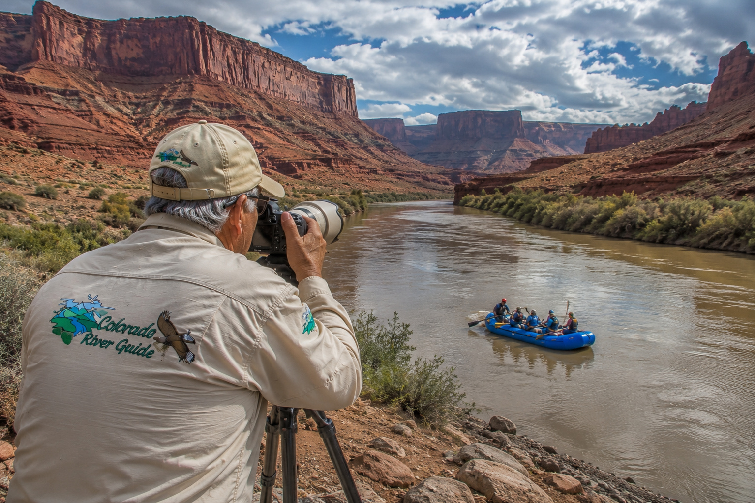
I enjoy photographing whitewater rafters.
There is a wonderful moment just before a raft enters a rapid.
Everyone is paddling.
The guide is calling commands.
The bow rises.
Then the river disappears beneath white spray.
That's when I press the shutter.
I'm perfectly content to experience that particular rapid through a telephoto lens.
Fishing the Colorado River Through Glenwood Canyon
Colorado Parks & Wildlife identifies brown trout and rainbow trout as the primary trout species through this part of the Colorado.
CPW considers the river from Rock Creek downstream toward Silt an important fishery and notes that Glenwood Canyon and Glenwood Springs provide unusually convenient public access through paved trails and parks. (Colorado Parks and Wildlife)
This is bigger water than we encountered near the headwaters.
A 9-foot 5-weight fly rod still works beautifully, although I might move to a 6-weight when throwing larger streamers or fishing higher flows.
Nymphing deep runs can be effective.
Dry flies come into their own during hatches.
Streamers appeal to larger browns.
Spinning anglers can work small spoons, spinners and minnow-style lures where regulations permit.
The important thing is knowing the regulations for the exact reach you're fishing.
CPW currently establishes special seasonal closures within 50 yards upstream and downstream of the confluences with Canyon, Elk, Grizzly and No Name creeks. Fishing there is prohibited March 15 through May 31 and October 1 through November 30, protecting important spawning activity. (Colorado Parks and Wildlife)
That is the kind of regulation I respect.
A healthy fishery begins with healthy spawning fish.
For more of my approach to moving-water trout, see fly fishing the Colorado River.
Colorado River Water Levels
River flow becomes increasingly important as the Colorado grows.
At 2:15 a.m. MDT on August 24, 2026, the USGS gauge below Glenwood Springs was reporting approximately 1,620 cubic feet per second.
That is a useful snapshot.
It is not tomorrow's promise.
Colorado River flows vary with snowmelt, rainfall, tributary inflow, upstream reservoir releases and water-management operations.
I check current flow before fishing or boating.
CPW also warns anglers that low summer flows combined with high temperatures can stress trout. Its current drought guidance notes that cold-water species become increasingly stressed as water approaches 71°F. (Colorado Parks and Wildlife)
I prefer being considerably more conservative.
If trout water is pushing into the upper 60s, particularly during low flow, I start thinking about putting the rod away.
There are other things to photograph.
Hanging Lake and the Colorado River Corridor
One of Glenwood Canyon's best-known natural attractions sits above the river at Hanging Lake.
The lake is reached by a steep trail climbing from the canyon.
Because the environment is delicate and heavily visited, timed-entry permits are required year-round.
Fishing, swimming and wading in Hanging Lake are prohibited. (Visit Glenwood Springs)
That's worth emphasizing.
Hanging Lake is not another fishing destination.
It is something to admire and protect.
No Name Creek and Grizzly Creek
The names along this stretch have personality.
No Name Creek enters the Colorado near the community of No Name.
Yes, that really is the name.
Farther east, Grizzly Creek drops into the Colorado through its own steep drainage.
Both tributaries contribute cold mountain water and aquatic habitat.
Tributary mouths often attract trout because they create changes in temperature, current and food supply.
But remember those CPW seasonal closures around certain creek mouths.
The fish know tributaries are important.
Wildlife managers do too.
Glenwood Springs: Where Two Rivers Meet
Then the canyon opens and we arrive at Glenwood Springs.
Here the Roaring Fork River joins the Colorado River at Two Rivers Park.
This is one of the most important tributary junctions we've encountered so far.
The Roaring Fork begins high in the mountains near Independence Pass and drains an extensive watershed including Aspen, Basalt and Carbondale.
Its tributaries include the Fryingpan and Crystal river systems.
When the Roaring Fork enters the Colorado, our river gains substantial additional flow.
The city itself grew around both rivers and its famous geothermal springs.
Water defines Glenwood Springs in almost every direction.
Cold mountain rivers.
Hot mineral springs.
Whitewater.
Fishing.
And a major interstate following the river west.
Two Rivers Park
Two Rivers Park sits near the confluence of the Roaring Fork and Colorado rivers and provides an important boating access point.
Many Glenwood Canyon rafting trips finish here.
Other boaters launch here and continue downstream.
That makes the park a useful transition between two different kinds of Colorado River.
Upstream is Glenwood Canyon whitewater.
Downstream the river begins broadening and slowing, although current remains strong and additional rapids and riffles appear.
The river is leaving canyon country.
For now.
Glenwood Whitewater Activity Area
West Glenwood Springs adds another curiosity: the Glenwood Whitewater Activity Area.
This engineered in-river feature creates a standing wave used by kayakers, stand-up paddleboarders and play boaters.
There is no boat ramp at the feature itself, and paddlers use it at their own risk. Helmets and personal flotation devices are required. (Visit Glenwood Springs)
Watching a good kayaker surf a standing river wave is impressive.
Watching from shore is also remarkably dry.
I appreciate that advantage more than I once did.
South Canyon River Access
Immediately downstream of Glenwood Springs, BLM manages South Canyon River Access.
The site includes parking, a restroom and concrete boat ramp.
Camping is not allowed.
BLM currently closes the site annually from November 15 through May 15. (Bureau of Land Management)
Access points like South Canyon make this portion of the Colorado particularly attractive to float fishermen.
You can construct trips of different lengths between public ramps rather than committing to an all-day expedition.
From Glenwood Springs Toward New Castle
West of Glenwood Springs, Interstate 70 continues following the river.
But the landscape changes.
The vertical confinement of Glenwood Canyon disappears.
The valley widens.
Cottonwoods and willows become increasingly prominent.
Ranches and communities spread along the corridor.
The Colorado River becomes broad enough that a fishing raft or drift boat begins making even more sense.
CPW specifically notes that boat anglers can float between public ramps associated with Glenwood Springs, New Castle, Silt and Rifle. (Colorado Parks and Wildlife)
For shore anglers, small I-70 pullouts can provide access to productive stretches that many travelers simply drive past.
That always amuses me.
Thousands of people may roar past at seventy miles per hour while a fellow below them quietly catches a rainbow trout.
New Castle, Silt and Rifle
These western Colorado communities grew in a landscape shaped by rivers, ranching, mining, agriculture and transportation.
New Castle sits directly along the Colorado River beneath the Grand Hogback.
Silt occupies a broader agricultural valley farther west.
Rifle developed around Rifle Creek and the Colorado River corridor.
By now we are noticeably lower in elevation than Grand Lake and Kremmling.
The vegetation changes.
The climate becomes warmer and drier.
And the fishery gradually begins transitioning as well.
Trout remain important, but farther downstream warmwater species become increasingly relevant.
That's another reminder that the Colorado River isn't one ecosystem.
It's a succession of ecosystems connected by moving water.
Colorado River Road
The Colorado River Road that accompanied us into Dotsero largely gives way to the Interstate 70 corridor for this chapter.
But county roads, frontage roads and local access routes repeatedly reconnect us with the river.
I like leaving the interstate whenever practical.
An interstate tells you how quickly you can reach Grand Junction.
A river road tells you what is between here and there.
Those are entirely different questions.
And I've become much more interested in the second one.
Parachute and the Colorado River
Farther west lies Parachute, near the mouth of Parachute Creek.
The surrounding country becomes increasingly dry.
Mesa country begins replacing the densely forested mountains of the upper basin.
The Colorado continues widening.
Interstate 70 remains close.
The railroad remains part of the corridor.
And the river keeps gathering tributaries and runoff from an increasingly broad watershed.
De Beque Canyon
Before reaching the Grand Valley, the Colorado enters another confined landscape: De Beque Canyon.
Here Interstate 70, the railroad and river once again squeeze together.
The geology has changed dramatically since Glenwood Canyon.
We're entering the Colorado Plateau country that will eventually dominate much of the river's journey through Utah and Arizona.
The mountains of the headwaters are beginning to surrender to mesas, cliffs and desert.
I enjoy watching that transition.
It's as though the Colorado River is slowly changing costumes.
Cameo and Plateau Creek
Near Cameo, another important tributary joins the Colorado.
Plateau Creek drains the high country and mesa landscapes to the south and east.
The USGS has long monitored Colorado River flows near Cameo because this is an important hydrologic point upstream of the Grand Valley.
By here, the Colorado has collected water from the Blue, Eagle, Roaring Fork and numerous smaller tributaries.
And we're still nowhere near the end.
Palisade: Where the River Meets Orchard Country
Then the canyon opens dramatically.
We enter the Grand Valley.
And suddenly there are orchards.
Vineyards.
Irrigated fields.
Cottonwoods.
Warm sunshine.
The town of Palisade has become famous for peaches and wine grapes.
Neither would flourish here on this scale without water.
The Colorado River turns an otherwise semi-arid valley into productive agricultural country.
That takes me back to my ranch upbringing.
Water determines what land can become.
It always has.
The river isn't merely passing through the Grand Valley.
It helped create the human landscape we see today.
Ancient People of the Grand Valley
Long before peach orchards, vineyards and irrigation canals, Native people understood the value of this river valley.
The Ute people lived and traveled throughout western Colorado.
Earlier prehistoric peoples also used the broader region.
The confluence of major rivers, abundant wildlife and relatively mild lower-elevation climate made the Grand Valley attractive country.
The nearby canyons and mesas contain archaeological evidence of long human occupation.
Once again, the pattern repeats.
Where water gathers, people gather.
Where rivers meet, cultures meet.
Grand Junction Colorado
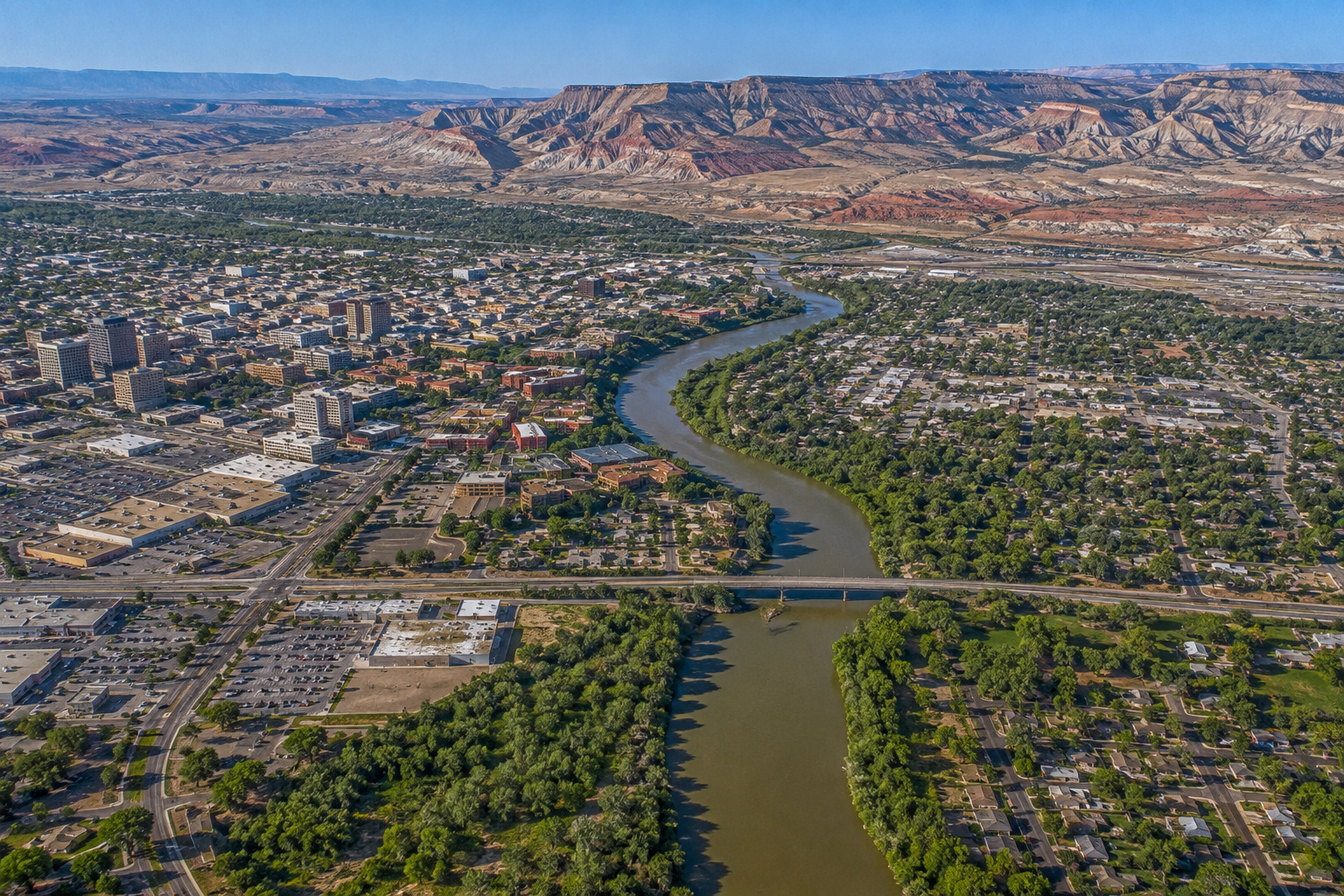
Eventually we reach Grand Junction, the largest city in western Colorado.
Its name tells the story.
"Grand" referred to the historic name of the upper Colorado River, once called the Grand River.
"Junction" refers to the joining of the Gunnison River and Colorado River.
This is a major hydrologic event.
The Gunnison is not a little mountain creek.
It drains an enormous portion of western Colorado, including watersheds extending into the San Juan and Elk mountains.
The Gunnison system includes major reservoirs such as Blue Mesa Reservoir, Morrow Point Reservoir and Crystal Reservoir, collectively associated with the Aspinall Unit.
When the Gunnison reaches Grand Junction, it substantially increases the Colorado River's flow.
The river leaving Grand Junction is not the same river that entered Glenwood Canyon.
It is bigger.
Warmer.
Broader.
And increasingly headed toward desert country.
Lakes and Reservoirs Feeding This Colorado River Reach
The main Colorado River between Dotsero and Grand Junction is primarily river rather than reservoir, but several upstream reservoir systems influence its tributaries and flow.
Those include:
Lake Granby, on the upper Colorado.
Dillon Reservoir, regulating the Blue River.
Green Mountain Reservoir, farther down the Blue.
Ruedi Reservoir, on the Fryingpan River, a tributary of the Roaring Fork.
Blue Mesa Reservoir, on the Gunnison River.
Morrow Point Reservoir, downstream of Blue Mesa.
Crystal Reservoir, completing the Aspinall Unit.
By the time we reach Grand Junction, the water passing beneath us has been influenced by a remarkable network of mountains, tributaries, reservoirs and water-management systems.
The Colorado River may look natural from the bank.
Hydrologically, its story is complicated.
Fishing Toward Grand Junction
CPW's Colorado River information specifically celebrates the return of rainbow trout below Glenwood Springs, along with established brown trout.
The farther west we travel, however, the river becomes warmer.
Eventually the fish community begins including warmwater species such as smallmouth bass, channel catfish and other species in addition to trout.
That creates an interesting transition zone.
I would still carry trout tackle around Glenwood Springs, New Castle, Silt and Rifle.
Farther west, especially as summer water warms, I'd begin thinking increasingly about warmwater fishing.
CPW's summer guidance is important here.
When cold-water streams approach 71°F, trout become stressed and are less likely to survive catch-and-release fishing. (Colorado Parks and Wildlife)
When that happens, I don't argue with the thermometer.
I find another fish to chase.
Or pick up the camera.
Public Access
One thing I appreciate about this stretch is the variety of access.
There are:
Glenwood Canyon rest areas.
The canyon recreation path.
Two Rivers Park.
South Canyon River Access.
I-70 pullouts.
Municipal parks.
Public boat ramps.
CPW fishing access.
BLM lands.
But access changes.
Road work happens.
High water closes facilities.
Wildfires alter landscapes.
Seasonal closures protect spawning fish.
So I always check the current Colorado Parks & Wildlife Fishing Atlas, which includes public fishing access, special regulations, boat ramps and links to stream gauges. (Colorado Parks and Wildlife)
A map printed ten years ago is interesting.
A current access map is useful.
Camping Between Dotsero and Grand Junction
Camping opportunities exist throughout the broader corridor, but this section is more developed than the country we traveled through near Pumphouse and Radium.
National forest campgrounds are available in surrounding mountain country.
Private campgrounds and RV parks operate near Glenwood Springs and communities farther west.
BLM lands provide additional opportunities in appropriate areas.
But don't assume that every river-access site permits overnight camping.
South Canyon, for example, specifically prohibits camping. (Bureau of Land Management)
I always verify before settling in.
Nobody enjoys being awakened at midnight and informed that his carefully selected campsite is actually a parking lot.
Wildlife Along the Colorado River
Colorado Parks & Wildlife manages an extraordinary range of wildlife across western Colorado.
Along this river corridor, depending upon habitat and elevation, we may encounter:
-
Rocky Mountain elk
-
Mule deer
-
Black bears
-
Mountain lions
-
Bobcats
-
Coyotes
-
Beaver
-
River otters
-
Bighorn sheep
-
Bald eagles
-
Golden eagles
-
Ospreys
-
Hawks
-
Great blue herons
-
Waterfowl
The river itself creates a long ribbon of habitat through increasingly dry country.
Cottonwoods provide nesting and roosting sites.
Willows provide cover.
Fish support eagles, ospreys and otters.
Agricultural fields attract deer and elk.
Cliffs provide habitat for bighorn sheep and raptors.
And the farther west we travel, the more valuable the river corridor becomes as the surrounding landscape dries.
Weather Through the Seasons
Spring: Snowmelt Takes Command
Spring means runoff.
Snow melting from the Rockies enters the Colorado through tributaries spread across thousands of square miles.
The river rises.
Water becomes colder, faster and often less clear.
Whitewater rafting begins becoming exciting.
Wade fishing can become difficult or dangerous.
This is a time to respect current.
Summer: Rafts, Trout and Heat
Summer brings prime recreation.
Rafts fill Glenwood Canyon.
The recreation path opens when conditions permit.
Campgrounds become busy.
Fishing can be excellent early in the day.
But as we travel west toward Grand Junction, summer temperatures rise considerably.
This is when I watch trout water temperatures carefully.
Fall: My Kind of Colorado
Fall may be my favorite season for this trip.
Cottonwoods turn yellow.
Temperatures moderate.
River traffic declines.
Wildlife becomes active.
The light softens.
The Grand Valley settles into harvest season.
For photography, fishing and simply wandering around, autumn is difficult to beat.
Winter: Two Different Worlds
Winter demonstrates how much elevation we've lost.
Glenwood Canyon may be icy and snowy.
Higher mountains are buried.
But Grand Junction can experience considerably milder and drier conditions.
The river continues flowing through both.
That's one of the things I enjoy about following it.
A river ignores our neat definitions of climate zones.
It simply passes through all of them.
Getting There
This may be one of the easiest portions of our entire Colorado River journey to navigate.
From Dotsero, take Interstate 70 west.
The interstate follows the Colorado River through Glenwood Canyon to Glenwood Springs.
Continue west through:
New Castle
Silt
Rifle
Parachute
De Beque
Palisade
and finally Grand Junction.
The driving distance is roughly 100 miles, depending upon starting and ending points.
You could drive it in a couple of hours.
I wouldn't.
Not if you're traveling with me.
We'll stop in Glenwood Canyon.
We'll watch rafters at Shoshone.
We'll photograph the river.
We'll check a fishing access.
We'll probably stop again at Glenwood Springs.
Then I will see an eagle.
Paulette already knows how this works.
By the time we reach Grand Junction, the two-hour drive may have consumed most of the day.
And I won't regret a minute of it.
The Colorado River Is Becoming a Western River
When we first found the Colorado River in Rocky Mountain National Park, it was almost delicate.
A little mountain stream beneath snow-covered peaks.
Now look at it.
The Blue River has joined it.
The Eagle River has joined it.
The Roaring Fork has joined it.
At Grand Junction, the Gunnison arrives.
The Colorado has cut through Glenwood Canyon.
It has carried rafters through whitewater.
It has watered ranches.
It has nourished cottonwood forests.
It has supplied communities.
It has grown from trout stream to substantial Western river.
And the landscape itself is changing.
Behind us are high mountain valleys.
Ahead of us is the Colorado Plateau.
Red rock.
Desert.
Utah.
Moab.
Canyonlands.
Lake Powell.
Grand Canyon.
Lake Mead.
Lake Mohave.
The little river we met in Rocky Mountain National Park is heading toward some of the grandest country on the continent.
If you'd like to peek far downstream at what eventually becomes of our mountain river, visit my Colorado River at Davis Dam and Lake Mohave guide, spend some time at Colorado River Davis Camp in Bullhead City, or walk with me along the Colorado River Heritage Trail at Lake Mohave.
Same river.
Completely different country.
But I'm getting ahead of myself.
For now, Paulette and I are standing near Grand Junction.
Behind us, the Colorado River has just traveled through a hundred miles of canyon, mountain and ranch country.
The Gunnison River is arriving from the south.
Ahead, the mountains are beginning to loosen their grip.
The desert is waiting.
And somewhere beyond the western horizon lies Utah.
I've got the camera ready.
There's plenty of gas in the truck.
And the Colorado River is still pointing the way.
Let's follow it.


0 Comments