
Colorado River Kremmling to Dotsero Colorado: Through Canyons, Hot Springs and Whitewater
Some stretches of the Colorado River invite you to sit quietly on the bank with a fly rod.
Others invite you to climb into a raft and hang on.
Between Kremmling and Dotsero, Colorado, we get both.
And quite a bit in between.
By the time Paulette and I reach Kremmling on our journey down the Colorado River, the little mountain stream we first met in Rocky Mountain National Park has changed considerably.
It has collected tributaries.
It has passed through Grand Lake, Shadow Mountain Lake and Lake Granby.
It has followed Highway 40 and the railroad through Middle Park.
The Blue River has joined it.
Now the mountains close around it.
Ahead lies Gore Canyon, where the Colorado River quits behaving like a pleasant trout stream and drops into some of the most formidable commercially rafted whitewater in the country.
Beyond Gore Canyon, however, the river settles down again.
There is Pumphouse Recreation Area.
Radium.
A warm spring beside the river.
Ranches.
Bighorn sheep country.
State Bridge.
Miles of Colorado River Road.
Public fishing access.
Boat launches.
Primitive campsites.
And eventually Interstate 70 and Dotsero.
This is one of those sections of the Colorado River where I could easily spend several days traveling thirty or forty miles.
That's because I have never been particularly good at driving past interesting water.
So let's leave Kremmling and see where the river takes us.
Leaving Kremmling on the Colorado River
Kremmling sits at one of the great river junctions of the upper Colorado.
The Blue River arrives from the south after flowing through Summit County and Dillon Reservoir.
The Muddy Creek drainage approaches from the north.
The Colorado River itself arrives from the east.
Together these waters begin creating a substantially larger river.
South of Kremmling, Colorado Highway 9 crosses country that has become an important example of modern wildlife conservation. Colorado Parks & Wildlife reports that seven wildlife crossing structures, five underpasses and two overpasses, were completed along a 10.5-mile section of Highway 9 in 2016.
During monitoring through April 2020, researchers documented more than 112,000 successful mule deer crossings, along with elk, black bears, moose, pronghorn, bobcats and numerous other species.
Wildlife-vehicle collision carcasses declined about 90 percent.
I find that encouraging.
We spend a great deal of time talking about the things humans have damaged in the West.
It is worth remembering that sometimes we also figure out how to fix something.
Into Gore Canyon
Then the river disappears into the mountains.
Gore Canyon is one of the defining geographic features of this entire stretch.
The Colorado River cuts directly through ancient rock of the Gore Range, including Precambrian gneiss and schist.
BLM describes the river as dropping about 68 feet per mile for roughly three miles through the canyon.
That's not a lazy float.
That's a river falling down a mountain.
Gore Canyon is widely regarded as the most challenging commercially rafted stretch in Colorado and perhaps one of the most demanding commercially rafted sections in the United States.
This is serious whitewater.
Expert kayakers and professional rafting outfitters know Gore Canyon well.
Casual boaters should know it well enough to stay out unless properly equipped, experienced and prepared.
The Colorado River doesn't award points for optimism.
Ancient People and the Colorado River Corridor
Whenever I travel through a natural corridor this obvious, I think about the people who traveled it before roads appeared on maps.
Native peoples used Colorado's mountain valleys for thousands of years.
The Ute people became especially associated with this part of the Rocky Mountains, moving seasonally through river valleys and mountain passes to hunt, gather plants, trade and travel.
Water determined movement.
So did geography.
A canyon that constrains us today constrained travelers centuries ago.
A broad valley that provides an easy road today provided an easier travel corridor then.
The difference is that they navigated without Highway 9 signs, GPS or a cheerful electronic voice telling them they had missed their turn.
Our article about The Original Coloradans explores more of that much older human relationship with the Colorado River.
Pumphouse Recreation Area
Once the Colorado escapes the worst of Gore Canyon, we arrive at one of the most important recreational access points on the upper river:
Pumphouse Recreation Area.
BLM manages Pumphouse as part of the Upper Colorado River Special Recreation Management Area.
This is not merely a gravel pullout beside the river.
Pumphouse is a substantial recreation complex with three developed boat-ramp areas, 18 individual campsites, two group campsites, vault toilets, day-use and overnight parking, hiking access and seasonal potable water when the system is operating.
BLM says more than 100,000 visitors use the broader recreation facilities annually, and Pumphouse is the most heavily used access point on the Colorado River between Kremmling and State Bridge.
For fishermen, rafters, kayakers and campers, this is one of the anchors of the trip.
For me, it is also where the Colorado begins changing character again.
The violence of Gore Canyon is behind us.
Ahead lies a friendlier river.
Not harmless.
Never harmless.
But friendlier.
The Gore Canyon Whitewater Playpark
Pumphouse also provides access to the Gore Canyon Whitewater Playpark, just above Boat Ramp #2.
A constructed river wave attracts kayakers, stand-up paddleboarders and other small-watercraft enthusiasts.
Boat Ramp #2 itself is actually a boat slide with steps.
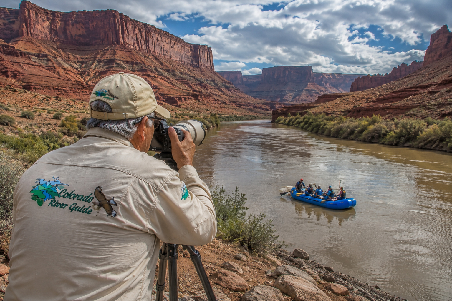
I enjoy watching skilled whitewater paddlers.
From shore.
With a camera.
There comes a point in life when a man recognizes that appreciating somebody else's adventure can be every bit as satisfying as volunteering to become part of it.
Whitewater Rafting Below Pumphouse
The popular rafting stretch below Pumphouse offers a different experience from Gore Canyon.
BLM describes water ranging from calm stretches to approximately Class III whitewater between Pumphouse and State Bridge.
That makes the river attractive to commercial rafting trips and experienced private boaters.
The scenery is excellent.
Canyon walls rise around portions of the river.
Ranch country opens between them.
Bald eagles and other wildlife may appear along the corridor.
And unlike traveling in a car, rafting forces you to move at the river's speed.
I've always liked that about boats.
Road travel teaches us to measure distance in miles per hour.
A river teaches us to measure it in bends.
Fishing Below Gore Canyon
Colorado Parks & Wildlife identifies the Colorado River from Rock Creek downstream toward Silt as an important trout fishery supporting brown trout and rainbow trout.
CPW specifically describes the stretch below Gore Canyon to Dotsero as a scenic wild river accessible along Colorado River Road, with shoreline access and boat ramps providing opportunities for both wading and float fishing.
That is exactly the kind of country that gets my attention.
Browns hold around boulders, undercut banks, deep runs and current seams.
Rainbows favor productive riffles and feeding lanes.
Depending upon season and water conditions, anglers can work dry flies, nymphs and streamers.
A 9-foot 5-weight fly rod remains my general-purpose choice.
For spinning tackle, a 6½- to 7-foot light or medium-light rod with 4- to 8-pound line handles much of the trout fishing.
But this stretch is particularly well suited to a drift boat or fishing raft.
A boat allows an angler to cover water that would otherwise be difficult or impossible to reach.
And some of the best-looking water always seems to be on the opposite bank.
That may be one of fishing's oldest laws.
For more of my approach to this style of fishing, visit fly fishing the Colorado River.
Colorado River Water Levels in August 2026
River flow matters enormously here.
It affects rafting difficulty, boat passage, wading safety, fishing locations and water temperature.
On the morning of August 24, 2026, the USGS Colorado River gauge near Kremmling was reporting approximately 708 cubic feet per second.
The historical median for August 24 at that gauge is about 1,030 cfs.
Water temperature early that morning was roughly 17.1°C, or about 62.8°F.
That temperature is already worth an angler's attention.
By afternoon, summer water may become considerably warmer.
Near Dotsero, the latest USGS reading showed approximately 847 cfs, compared with an August 24 historical median of roughly 1,480 cfs.
Those figures tell me something important.
Check the river before you leave.
Not last month's report.
Not last year's fishing story.
Today's river.
Flow can change because of precipitation, reservoir operations, diversions and tributary inflow.
I also carry a thermometer when trout fishing in summer.
When trout water approaches the upper 60s Fahrenheit, I become increasingly conservative about catch-and-release fishing.
Sometimes the responsible fishing decision is to quit fishing.
Feeder Tributaries Between Kremmling and Dotsero
This portion of the Colorado continues gathering water.
Important tributaries and drainages in the broader corridor include:
Blue River, joining near Kremmling.
Muddy Creek, contributing from the north near the Kremmling area.
Piney River, draining mountain country farther south.
Sheephorn Creek, entering from rugged country north of the river.
Rock Creek, another tributary in the State Bridge-to-Dotsero region.
Numerous smaller creeks, gulches and seasonal drainages also feed the Colorado.
Every tributary adds something.
Water.
Sediment.
Cold-water refuge.
Aquatic insects.
Spawning habitat.
Nutrients.
The Colorado River is becoming larger one creek at a time.
Radium Colorado
Continue downstream and we reach tiny Radium, Colorado.
I like places where the population sign isn't really necessary.
Radium sits beside the Colorado River in a remarkably scenic setting surrounded by rugged hills and canyon country.
The railroad remains part of the landscape.
So does ranching.
And the river remains the main attraction.
BLM's Radium Recreation Area provides two developed boat-ramp sites, day-use and overnight parking, nine vault toilets, 16 individual campsites, two group campsites and picnic shelters.
There is no potable water, so bring your own.
Radium is roughly 20 miles west of Kremmling by the river-road route.
It makes a natural stopping point for fishermen, rafters and campers.
Radium Hot Spring
One of the best-known curiosities along this stretch is Radium Warm Springs, commonly called Radium Hot Spring.
The small warm-water pool sits near the Colorado River.
But there is an important current access issue.
The old informal route from the Radium Recreation Area is not an approved trail.
BLM specifically says there is currently no designated trail from the recreation area directly to the spring.
Parking along narrow Radium Road is prohibited.
Even more importantly, the old CPW Mugrage Site and social trail that once provided access through the Radium State Wildlife Area have been closed to protect important wildlife habitat, including bighorn sheep habitat.
BLM recommends using the signed route via Warm Springs Road, reached from Trough Road northeast of the Radium Recreation Area.
I respect closures like that.
The whole point of coming into this country is to enjoy what remains wild.
It makes little sense to damage wildlife habitat in pursuit of recreation.
Radium River Access and Camping
For visitors planning to stay overnight, the Radium Recreation Area campground is the appropriate developed BLM option.
Reservations are required for campsites.
The setting puts you directly beside the Colorado River.
No motel lobby.
No traffic lights.
No television necessary.
Just water moving past camp and mountains darkening at sunset.
That's my idea of suitable accommodations.
BLM closes campground services during winter, generally from December through March, and there is no potable water at the site.
Bring enough drinking water for the entire stay.
Then bring a little more.
Bighorn Sheep Country
Radium and the surrounding canyon country are important habitat for Rocky Mountain bighorn sheep.
That's one reason current trail closures deserve respect.
Bighorns occupy steep, rocky country where cliffs provide escape terrain.
Early morning and evening can offer good opportunities to scan canyon walls.
I use binoculars first.
Then the telephoto lens.
A bighorn ram on a cliff above the Colorado River is precisely the sort of photograph that can make me forget I was supposed to be fishing.
Paulette is accustomed to this.
A fishing trip can become a wildlife photography trip without notice.
Trough Road and Colorado River Road
One of the pleasures of this section is traveling beside the river.
From Kremmling toward State Bridge, Grand County Road 1, commonly called Trough Road, follows the Colorado River corridor.
It forms part of the Colorado River Headwaters Scenic and Historic Byway.
This isn't Interstate 70.
And that's exactly why I like it.
The road winds through ranch country and canyon landscapes, repeatedly bringing travelers back to the river.
BLM recreation sites appear along the way.
Pullouts provide views.
The railroad continues sharing the corridor.
Eventually Trough Road reaches State Bridge.
Beyond there, the river journey continues toward Dotsero along the road commonly known as Colorado River Road.
This is one of those drives where the road itself becomes part of the story.
State Bridge Recreation Site
State Bridge has been important to travelers for a very long time.
The original bridge across the Colorado River was constructed in 1860, making it one of Colorado's earliest vehicular bridges.
It became important to development of North Park and the Yampa Valley.
The original bridge was replaced in 1966, but remnants of the old structure remain visible in and beside the river.
Today, the BLM State Bridge Recreation Site provides public river access.
Facilities include a paved boat launch, a separate unpaved small-craft launch, parking, toilets, dressing rooms, garbage service and non-potable water.
The site is day use only.
This is also an important dividing point for recreational traffic.
BLM notes that the Pumphouse-to-State Bridge stretch receives heavy use.
Below State Bridge, boat traffic traditionally becomes lighter.
That appeals to me.
The farther downstream we go, the quieter the river begins to feel again.
Fishing State Bridge to Dotsero
Below State Bridge, the Colorado remains excellent trout country.
CPW describes the river all the way toward Dotsero as a quality fishery containing brown and rainbow trout.
The Colorado River Road provides access to shorelines and boat launches.
For float fishermen, this creates several possibilities for constructing trips of different lengths.
For bank and wade anglers, access points provide opportunities to explore individual stretches.
I would concentrate on:
riffle transitions, deep outside bends, boulder pockets, undercut banks, tributary mouths, current seams and shaded banks.
Early morning becomes particularly important during summer.
Not merely because trout may feed actively.
Because water is cooler.
The fish come first.
Horse Creek River Access and Boat Launch
Farther downstream, Horse Creek River Access and Boat Launch provides another useful point for boaters and anglers exploring the Colorado River Road corridor.
Sites such as Horse Creek help divide what would otherwise be a long float into manageable sections.
That is especially useful for fishermen.
A ten-mile float while casting isn't remotely the same thing as a ten-mile float while simply traveling downstream.
Every riffle slows you down.
Every rising trout slows you down more.
And if I see an eagle, apparently the boat stops altogether.
When planning any float, confirm the current condition and status of your intended launch and takeout before leaving home.
River access facilities can change seasonally.
Public Access Along the Colorado River Road
One of the great advantages of the Kremmling-to-Dotsero section is the amount of public access associated with BLM-managed lands and recreation sites.
But the corridor is not entirely public.
Private ranches remain part of the landscape.
Railroad property also creates boundaries.
My rule is simple:
If access isn't clearly public, I don't assume it is.
Use designated river access.
Respect fences.
Close gates.
Don't block roads.
Pack out trash.
And leave a campsite cleaner than you found it.
Those aren't complicated ideas.
They're simply good manners carried outdoors.
Camping Along the Colorado River
Pumphouse and Radium provide developed camping.
Additional primitive and boat-access campsites occur along portions of the upper Colorado recreation corridor.
Camping beside the river changes the rhythm of a trip.
Instead of driving to the water at dawn, you wake beside it.
I enjoy that.
First light reaches the canyon wall.
A few birds begin calling.
The river has been making the same sound all night.
Coffee goes on.
And somewhere nearby, a trout begins rising.
That is a civilized morning, regardless of what the hotel industry might say.
Campers need to check current BLM regulations, reservation requirements, fire restrictions and seasonal closures.
Fire restrictions can change quickly during dry Western summers.
Wildlife Along the Kremmling-to-Dotsero Colorado River
This corridor supports an impressive range of wildlife.
Colorado Parks & Wildlife information for the broader region and BLM habitat descriptions point to animals including:
Rocky Mountain bighorn sheep
Elk
Mule deer
Moose
Black bears
Mountain lions
Bobcats
Coyotes
River otters
Beaver
Bald eagles
Golden eagles
Ospreys
Hawks
Waterfowl
The Colorado River provides a natural travel corridor.
Riparian vegetation supplies food and cover.
Cliffs provide nesting and escape habitat.
Fish support eagles, ospreys and otters.
CPW's Highway 9 monitoring near Kremmling documented just how many species move through this landscape.
For a photographer, that means keeping the camera within reach.
Always.
Weather Through the Seasons
Spring: Runoff Takes Control
Spring in the high country eventually becomes runoff season.
Snow melts throughout the watershed.
Tributaries rise.
The Colorado gains volume and speed.
For rafters, high water can mean excitement.
For wade fishermen, it can mean danger.
Never underestimate current.
A river doesn't need to be deep to knock you down.
Summer: Rafts, Trout and Thunderstorms
Summer is the great recreation season.
Rafts appear.
Campgrounds fill.
Fishermen start early.
Afternoon thunderstorms can build rapidly.
Lightning, flash runoff from tributaries and changing wind deserve attention.
Water temperature also becomes increasingly important for trout anglers.
Fall: My Favorite
Fall is difficult to beat.
Cottonwoods begin changing color.
Mornings become cold.
River traffic declines.
Trout become active.
Elk begin their autumn routines in surrounding country.
The light becomes wonderful for photography.
If somebody told me I could have only one season along this stretch, I'd take fall and not spend much time negotiating.
Winter: A Different River
Winter empties the campgrounds.
Snow covers the surrounding country.
Some BLM facilities reduce or close services.
Ice forms along shorelines.
The river becomes quieter.
Wildlife moves into winter ranges.
It can be extraordinarily beautiful.
It can also be unforgiving.
Travel prepared.
Dotsero Colorado
Eventually the Colorado River approaches Dotsero.
The little community sits at one of the most geographically interesting locations in this part of Colorado.
The name Dotsero is associated with railroad history, but the landscape itself has a much older story.
Nearby Dotsero Volcano is one of Colorado's youngest volcanic features.
And just downstream waits another dramatic transformation:
Glenwood Canyon.
But we'll save that for the next chapter.
Dotsero also marks our reunion with Interstate 70.
After miles of quieter river roads, ranches, gravel and canyon country, the interstate suddenly returns us to modern transportation.
Cars and trucks race beside a river that has been traveling toward this point for thousands of years.
The contrast is hard to miss.
Interstate 70 and the Colorado River
From Dotsero westward, Interstate 70 and the Colorado River enter Glenwood Canyon together.
It is one of America's most remarkable highway corridors.
But east of Dotsero, our route has been considerably quieter.
Travelers coming from Denver or the Front Range can reach Dotsero using I-70.
From Dotsero, turning north onto the Colorado River Road allows exploration upstream toward State Bridge.
That means this entire journey can be traveled either direction.
I prefer downstream.
There's something satisfying about following the water.
Getting There
From Kremmling
From Kremmling, travel south on Colorado Highway 9 roughly a mile toward the intersection with Grand County Road 1.
Turn west onto Trough Road, the Colorado River Headwaters Scenic and Historic Byway.
Follow the river toward Pumphouse, Radium and State Bridge.
From Interstate 70
For State Bridge, take I-70 Exit 157 at Wolcott, then travel north on Colorado Highway 131.
State Bridge lies roughly 14 miles from the interstate.
From Dotsero
Take I-70 Exit 133 at Dotsero and connect with the Colorado River Road to explore upstream.
This is particularly convenient for reaching downstream river-access sites.
Road conditions can change with weather.
Some gravel sections may become rough, muddy or snow-covered.
Check before traveling.
From Kremmling to Dotsero: A Colorado River I Could Linger On
This chapter began in Kremmling.
The Blue River had just joined us.
Then the Colorado disappeared into Gore Canyon.
It crashed through whitewater.
It emerged at Pumphouse.
We watched rafters.
We looked for trout.
We camped beside the river.
We passed Radium and its warm spring.
We scanned cliffs for bighorn sheep.
We followed Trough Road to State Bridge.
Then Colorado River Road carried us through quieter country toward Dotsero.
And through it all, the river kept growing.
That's what I find so fascinating about following the Colorado River from beginning to end.
There isn't one Colorado River.
There are dozens.
The little trout stream in Rocky Mountain National Park doesn't look like Gore Canyon.
Gore Canyon doesn't look like Lake Mohave.
Lake Mohave doesn't look like the lower river approaching Mexico.
Yet every one is the same river.
Readers who would like to jump far downstream for a glimpse of that transformation can visit my Colorado River at Davis Dam and Lake Mohave guide, explore Colorado River recreation at Davis Camp, or walk the Colorado River Heritage Trail at Lake Mohave.
But I'm not ready for the desert yet.
I'm standing near Dotsero.
Behind me lies Gore Canyon.
Ahead of me is Glenwood Canyon.
I can hear Interstate 70.
I can hear the river.
And if I had to choose which one to follow, there was never much doubt.
The Colorado River wins.
Let's keep going.

0 Comments