After following the Colorado River from its snowy beginning high in Rocky Mountain National Park, I've reached a part of the journey that Paulette and I know particularly well.
We've crossed Colorado.
Followed red-rock Utah.
Watched the river disappear beneath Lake Powell.
Traveled through Grand Canyon.
Entered Lake Mead.
Then we reached our winter home water at Lake Mohave, where our place above Katherine Landing gives us the luxury of deciding to go fishing based upon little more than the morning wind.
Now we leave Lake Mohave behind.
The Colorado River passes through Davis Dam, slides between Bullhead City and Laughlin, continues south through the broad Mohave Valley toward Needles, California, passes beneath Interstate 40 and then enters one of the prettiest stretches of river on the entire lower Colorado.
Topock Gorge.
This is a different kind of fishing.
We're leaving reservoir fishing behind for a while.
Current matters more.
Backwaters matter more.
Eddies matter more.
The position of the river channel matters a whole lot more.
And unlike a sprawling reservoir where I can usually swing wide around trouble, Topock Gorge sometimes puts fishermen, pleasure boats, kayaks, shallow bars and underwater hazards into the same relatively narrow piece of water.
So this chapter comes with an unusually strong message from an old boat driver:
Slow down, stay sober, read the water and pay attention.
There's plenty of river for everybody if everybody uses a little sense.
From Lake Mohave Back Into the Colorado River
Our previous chapter followed the Colorado River through Lake Mohave, the long clear reservoir between Hoover and Davis dams.
Below Davis Dam, the Colorado becomes a river again.
It passes between Bullhead City, Arizona, and Laughlin, Nevada, then continues south toward Fort Mohave and Needles.
Arizona Game and Fish manages the Colorado River reach from Davis Dam to Lake Havasu as an important sport-fishing corridor, including smallmouth bass, striped bass and other species. (Arizona Wildlife Conservation Strategy)
This is one of the things I enjoy about following the Colorado from beginning to end.
A fisherman has to keep changing gears.
Upstream at Lake Mohave, I might spend half an hour working a submerged point in twenty-five feet of clear water.
Down here, I'm reading current seams and looking for one submerged tree creating a two-foot-wide patch of quiet water.
Same bass fisherman.
Different classroom.
Needles, California: Gateway to Topock Gorge
Needles, California sits on the western bank of the Colorado just north of Topock Gorge.
Interstate 40 crosses the river nearby, making Needles one of the easiest access points along this section of the lower Colorado.
The town took its name from the distinctive pointed mountain formations in the area, and it has long been a transportation crossroads.
Railroad.
Route 66.
Interstate 40.
And, long before any of those, the Colorado River itself.
Needles is also one of my favorite practical jumping-off points for fishing this stretch.
Jack Smith Memorial Park, at the end of River Road about two miles from Interstate 40, provides a boat launch and overnight parking. My Lake Havasu Sports Guide notes good smallmouth fishing south of the park toward Lake Havasu, with Topock Gorge only a short boat run downstream. (Lake Havasu Sports Guide)
That's exactly the kind of launch I like.
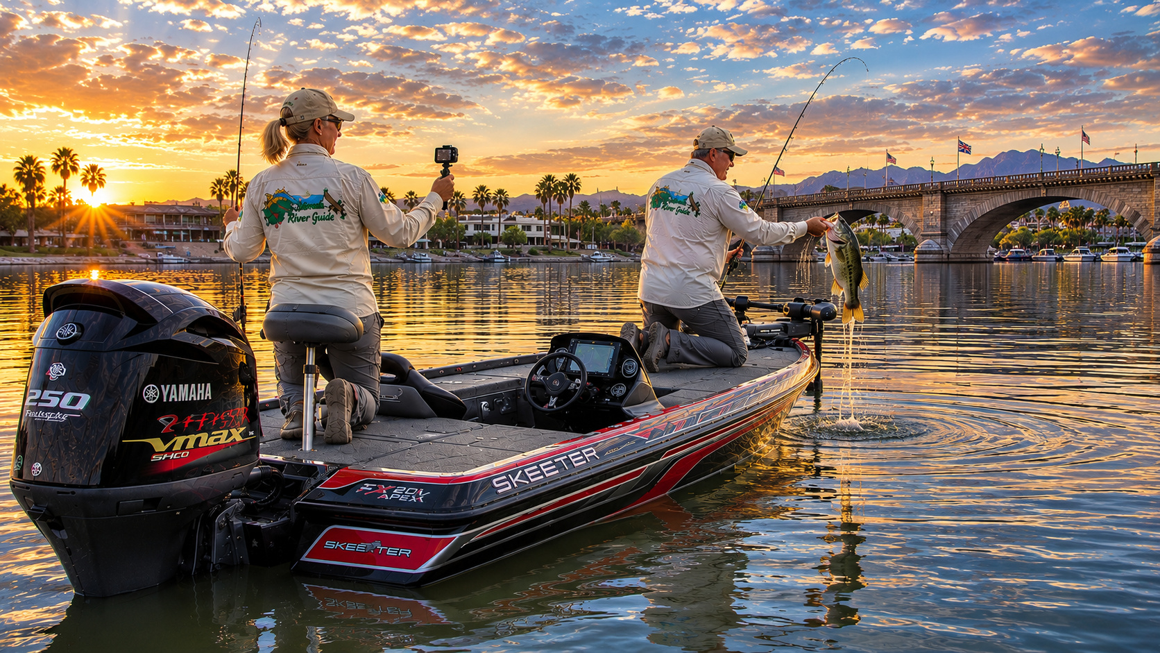
Put the Skeeter in.
Lower the Yamaha.
Check everything one more time.
And head south.
But don't immediately shove the throttle into the corner.
The Colorado isn't Lake Mohave.
Topock Gorge: Twenty Miles of Natural Colorado River
Once we pass the Interstate 40 area, the character of the river begins changing dramatically.
Topock Gorge forms roughly 20 miles of natural river channel within Havasu National Wildlife Refuge.
The U.S. Fish & Wildlife Service calls it one of the last remaining natural stretches of the Lower Colorado River. Havasu National Wildlife Refuge itself protects about 30 river miles and 300 miles of shoreline between Needles and Lake Havasu City. (U.S. Fish and Wildlife Service)
That word natural deserves attention.
Much of the lower Colorado has been dammed, dredged, channelized, diverted or otherwise engineered.
Topock Gorge still lets us glimpse something closer to the river that existed before we began rearranging it.
Steep volcanic and rocky canyon walls squeeze the river.
Backwaters branch away from the main channel.
Reeds and riparian vegetation appear along protected margins.
Bighorn sheep country rises above us.
Raptors circle overhead.
And bass live underneath.
That's a combination capable of distracting a fisherman.
Fortunately, Paulette usually has the camera handy.
Ancient People Along the Colorado River
Whenever I write about this lower river country, I try to remember that calling it "untouched wilderness" would be historically wrong.
People have lived along the Colorado for thousands of years.
The Mojave people developed an especially close relationship with the lower river. Traditional Mojave country extended along both sides of the Colorado, and the river provided water, fertile floodplain soil, transportation and food.
The river was not scenery.
It was life.
Topock Gorge also contains places of continuing cultural significance. The Fish & Wildlife Service notes that Native American petroglyphs are visible from the river in portions of the gorge. (U.S. Fish and Wildlife Service)
I treat those places with the same respect I'd want someone to show an old family cemetery back in Kansas.
Look.
Photograph where appropriate and permitted.
Learn.
But don't touch, carve, remove or disturb anything.
The refuge explicitly protects archaeological resources and prohibits their removal. (U.S. Fish and Wildlife Service)
Some things don't belong in our souvenir collection.
The Colorado River Has Very Few Feeder Tributaries Here
Unlike the upper Colorado, where rivers such as the Green, Gunnison and San Juan contribute enormous watersheds, this lower desert reach receives relatively little perennial tributary flow.
The Colorado River itself dominates the system.
Numerous desert washes drain into the corridor, but most remain dry until storms arrive.
That changes during monsoon season.
A thunderstorm several miles away can suddenly send muddy water, sediment and debris down a wash that was bone dry earlier that morning.
Farther south, the Bill Williams River becomes a significant tributary entering Lake Havasu near the reservoir's southern end.
But through Topock Gorge, we're essentially fishing the Colorado and its associated backwaters.
Water Levels: Think River, Not Reservoir
One mistake a Lake Mohave fisherman can make after coming through Davis Dam is continuing to think like a reservoir fisherman.
Topock Gorge water levels are influenced by upstream dam releases and downstream river-management operations.
Flow can change.
Current speed can change.
A shallow bar that was comfortably submerged on one trip can become troublesome on another.
The apparent width of the river can fool you.
A hundred yards of water doesn't necessarily mean a hundred yards of navigable channel.
That's important enough to repeat:
Water is not the same thing as channel.
Some of the prettiest shallow water in the gorge is exactly where I do not want my Yamaha lower unit traveling at speed.
I use current navigation information, electronics and visual cues, and when uncertain I slow down.
Replacing a lower unit is expensive.
Replacing a life is impossible.
Topock Marsh: Close to the River, But Not the River
One geographical distinction deserves clarification.
Topock Marsh lies adjacent to the Colorado River within Havasu National Wildlife Refuge.
It covers roughly 4,000 acres and provides tremendous wetland habitat. (U.S. Fish and Wildlife Service)
But the marsh boat ramps at North Dike, Five Mile Landing and Catfish Paradise do not provide boating access to the main Colorado River. (U.S. Fish and Wildlife Service)
That's easy to misunderstand when looking at a map.
The marsh has bass, crappie, catfish and carp and can be an interesting fishery in its own right. Refuge staff actively manage its water levels through irrigation canals to maintain wildlife habitat. (U.S. Fish and Wildlife Service)
Part of Topock Marsh is seasonally closed to entry beginning October 1 through the end of the state waterfowl season, so I always check current refuge rules before fishing there. (U.S. Fish and Wildlife Service)
Havasu National Wildlife Refuge
The gorge lies within one of the ecological jewels of the lower Colorado.
Havasu National Wildlife Refuge was established in 1941 primarily to protect migratory bird habitat.
Today it encompasses about 37,515 acres along the Arizona-California border. (U.S. Fish and Wildlife Service)
More than 300 bird species have been documented within the refuge, and Fish & Wildlife currently lists 318 species using its diverse habitats. (U.S. Fish and Wildlife Service)
That's enough to keep Paulette and me looking upward almost as much as we're looking into the water.
Wildlife in Topock Gorge
This is excellent wildlife photography country.
I watch the canyon walls for desert bighorn sheep.
The refuge also supports:
Coyotes.
Bobcats.
Foxes.
Mountain lions.
Jackrabbits.
Beavers.
Bats.
Gambel's quail.
Roadrunners.
Great blue herons.
Great egrets.
Ospreys.
Peregrine falcons.
Waterfowl.
Western and Clark's grebes.
Bell's vireos.
Yuma Ridgway's rails.
And plenty more.
Fish & Wildlife notes that thousands of bats emerge from historic mines in the refuge wilderness, while peregrine falcons hunt among the cliffs and desert bighorn negotiate the canyon walls. (U.S. Fish and Wildlife Service)
Topock Gorge is one of those places where fishing can be interrupted by something considerably more interesting than fishing.
I consider that a good problem.
Fishing Topock Gorge Is Not Lake Fishing
Now we get to the fun part.
I approach Topock Gorge bass fishing differently from Lake Mohave or Lake Havasu.
On a lake, structure often dominates my thinking:
Points.
Ledges.
Humps.
Drop-offs.
Submerged channels.
On the river, I add another major variable:
Current.
Bass are efficient predators.
They don't want to spend all day swimming against strong current if they can hold behind something and let dinner come to them.
So I'm looking for anything that interrupts flow.
Rock points.
Boulders.
Laydowns.
Reeds.
Tules.
Submerged trees.
Cut banks.
Small islands.
Backwater mouths.
Eddies.
Current seams.
Channel bends.
A bass may sit in nearly motionless water only inches away from current carrying food past its nose.
That little seam is where my lure belongs.
Largemouth Bass Habitat
For largemouth bass, I favor the slower water.
Backwaters.
Protected pockets.
Reed lines.
Submerged brush.
Wood.
Aquatic vegetation.
Cuts behind islands.
Warm shallow bays.
The refuge's remaining backwater habitats are ecologically important precisely because they differ so much from the faster main channel. (U.S. Fish and Wildlife Service)
Largemouth tend to appreciate that difference too.
Where the current slows and vegetation thickens, I start thinking green fish.
Smallmouth Bass Habitat
For smallmouth, I lean more heavily toward:
Rock.
Current.
Channel edges.
Riprap.
Rocky points.
Boulder banks.
Hard-bottom transitions.
Bridge structure where fishing is permitted and safe.
Current breaks.
My Lake Havasu Sports Guide has long identified good smallmouth bass fishing south of Jack Smith Park along the Colorado toward Lake Havasu. (Lake Havasu Sports Guide)
Arizona Game and Fish likewise recognizes smallmouth bass throughout Lake Havasu and the Colorado River system. (Arizona Game and Fish Department)
This is perfect light-tackle river fishing.
January: Slow Down
January water is cool.
Bass metabolism slows.
I fish deeper current breaks and protected backwaters where temperatures may be slightly warmer.
For smallmouth:
Ned rigs.
Tubes.
Drop shots.
Small jigs.
Suspending jerkbaits.
For largemouth:
Texas-rigged finesse worms.
Small jigs.
Slow spinnerbaits on warming afternoons.
The trick is not making January fish behave like May fish.
Slow down.
February: Follow the Sunshine
By February, sunny afternoons begin warming protected backwaters.
A two- or three-degree temperature difference can matter.
I look for dark bottom, protected shoreline and reduced current.
Bass begin positioning closer to spawning habitat.
Jerkbaits become particularly useful around rocky smallmouth water.
I prefer translucent shad colors in clear water and slightly more visible patterns if runoff or boat traffic stains the river.
March: Pre-Spawn River Bass
March is when things become interesting.
Smallmouth begin moving toward protected gravel and rocky spawning habitat.
Largemouth move toward shallow backwaters.
I work:
Backwater mouths.
Secondary current breaks.
Rock-to-gravel transitions.
Protected pockets.
Reed edges.
Laydowns.
This is prime time for a 3- to 4-inch tube, Ned rig, finesse worm or compact jig.
April: Spawn Time
April can provide some of my favorite fishing.
Water temperature, weather and daily flow all influence exact timing, but once protected areas reach the appropriate range, both largemouth and smallmouth move shallow.
For smallmouth, I search clear gravel pockets away from heavy current.
For largemouth, I look toward protected backwaters with hard bottom near vegetation or woody cover.
I keep the boat well away from visible beds.
River fish can be surprisingly spooky in clear water.
Polarized glasses earn their keep.
May: Post-Spawn and Fry Guarders
By May, some bass remain spawning while others guard fry or begin feeding heavily after the spawn.
This is when topwater fishing begins getting interesting.
A small walking bait worked along a current seam at first light can draw a violent smallmouth strike.
For largemouth I like:
Soft-plastic stickbaits.
Flukes.
Spinnerbaits.
Texas rigs.
Topwaters.
And shallow-running crankbaits around wood.
June: Follow Shade and Current
June heat begins changing the daily rhythm.
I fish early.
Smallmouth use current and deeper rock.
Largemouth seek shade, vegetation and protected backwaters.
The river itself provides oxygen and moving forage, which can keep fish more active than bass sitting in stagnant shallow water.
I like swimbaits through current seams and crankbaits along rocky banks.
July and August: Dawn Is Your Friend
This is serious desert heat.
I don't need a weather app to tell me that standing on a bass boat deck at two o'clock in July is unnecessary.
I fish early.
Very early.
Summer bass often feed aggressively around dawn before retreating toward deeper water, shade or heavy cover.
Topwater can be tremendous.
Then I switch to:
Swimbaits.
Drop shots.
Texas rigs.
Jigs.
Deep crankbaits where the channel allows.
And I carry far more drinking water than I think we'll need.
September: The First Hint of Relief
September remains hot, but nights slowly begin moderating.
Baitfish movement becomes increasingly important.
Smallmouth chase forage along current seams and rocky banks.
Largemouth become more active around backwater mouths.
This is excellent spinnerbait and crankbait time.
October: Fall River Fishing
October may be my favorite all-around month in Topock Gorge.
Temperatures become civilized.
Boat traffic begins easing.
Bass feed.
Wildlife becomes more comfortable moving during daylight.
Shad-colored crankbaits, jerkbaits and swimbaits become major players.
I cover water until the fish tell me where to stop.
November: Slow Water Becomes Important Again
Cooling temperatures begin pulling bass toward winter patterns.
I focus increasingly on deeper eddies, rock and protected backwaters.
Smallmouth still feed actively during favorable periods.
A sunny November afternoon can produce surprisingly shallow fish.
Ned rigs and tubes begin creeping back toward the top of my tackle list.
December: Quiet River, Finesse Fishing
December brings us full circle.
The gorge becomes quieter.
Pleasure traffic declines dramatically.
Fishing slows, but the experience improves in another way.
This is when I can drift beneath canyon walls and hear birds instead of engines.
Finesse wins.
Slow presentations.
Light line.
Good electronics.
And patience.
My Topock Gorge Smallmouth Tackle
My primary smallmouth outfit:
Rod: 6'10" to 7'2" medium-light spinning rod
Reel: 2500-size spinning reel
Main line: 8- to 10-pound braid
Leader: 6- to 10-pound fluorocarbon
Favorite lures:
-
2¾- to 4-inch Ned rigs
-
3- to 4-inch tubes
-
3½- to 5-inch drop-shot worms
-
3- to 4-inch paddletail swimbaits
-
3½- to 5-inch jerkbaits
-
⅛- to ⅜-ounce jigs
-
Small crankbaits
-
Walking topwaters
Colors:
Green pumpkin.
Brown.
Smoke.
Watermelon.
Natural crawfish.
Pearl.
Ghost shad.
Silver.
Current determines weight.
If my bait never reaches the strike zone, color doesn't matter much.
My Topock Gorge Largemouth Tackle
For largemouth around heavier cover:
Rod: 7-foot medium-heavy casting rod
Reel: 7:1 baitcasting reel
Line: 12- to 17-pound fluorocarbon
When fishing thick vegetation or nasty wood, I'll use braid.
Lures:
-
⅜-ounce Texas-rigged worms
-
4- to 6-inch stick worms
-
Compact creature baits
-
⅜- to ½-ounce jigs
-
Spinnerbaits
-
Chatter-style vibrating jigs
-
Shallow crankbaits
-
Flukes
-
Frogs around appropriate surface vegetation
-
Walking baits and poppers
Green pumpkin is hard to beat.
Black-and-blue gives me contrast in stained backwaters.
White and shad colors excel around baitfish.
Depth: The River Changes the Rules
Topock Gorge isn't a place where I simply say, "Bass are twenty-five feet deep," and spend the day looking for that contour.
River fish use position as much as depth.
A smallmouth may hold in eight feet behind a boulder beside a twenty-foot channel.
A largemouth may sit in three feet beneath reeds fifty yards from fast water.
I fish the relationship between:
Depth.
Current.
Cover.
Shade.
Temperature.
Forage.
That's river fishing.
The best spot may be tiny.
Sometimes the entire pattern is one stump.
Aquatic Vegetation and Backwater Habitat
The lower Colorado historically supported extensive cottonwood-willow riparian forests and wetland habitat.
Dams and river regulation changed that ecosystem dramatically. Havasu National Wildlife Refuge now protects and restores remaining cottonwood, willow, mesquite, marsh and backwater habitat. (U.S. Fish and Wildlife Service)
For bass anglers, vegetation can include emergent reeds, submerged aquatic growth and flooded shoreline cover.
Don't overlook it.
A single green patch surrounded by barren rock can hold several largemouth.
Lake Havasu Begins at the South End of the Gorge
Eventually Topock Gorge begins opening.
The Colorado spreads.
The canyon walls retreat.
And the river becomes Lake Havasu.
Arizona Game and Fish considers Lake Havasu one of Arizona's premier fisheries, with management focused strongly on quality largemouth and smallmouth bass fishing. (Arizona Wildlife Conservation Strategy)
Lake Havasu is our next major destination, and it deserves its own chapter.
London Bridge.
Artificial fish habitat.
Smallmouth.
Largemouth.
Redear sunfish.
Stripers.
And some fascinating bass-fishing history.
But before we get there, we have to get through the gorge safely.
Boating Safety: Topock Gorge Demands Respect
This section deserves more space than I normally devote to boating safety.
I've spent a substantial part of my life operating boats.
I've also spent thousands of hours flying airplanes.
Both activities taught me the same lesson:
Complacency is expensive.
Topock Gorge combines several hazards:
Shallow water.
Changing river conditions.
Submerged rocks and bars.
A narrow navigable corridor in places.
Blind bends.
Kayaks.
Fishing boats moving slowly.
High-performance boats moving very quickly.
Heavy weekend traffic.
And alcohol.
That last combination deserves particular attention.
California's Division of Boating and Waterways says alcohol remains a major contributor to fatal recreational boating accidents, and its 2026 Operation Dry Water campaign specifically brought California, Arizona and federal law-enforcement partners together in the Lake Havasu/Colorado River area. (CA State Parks)
In California, operating a vessel at 0.08 percent BAC or above is illegal, and an operator can still be arrested below 0.08 if circumstances demonstrate unsafe impairment. (CA State Parks)
For me, the rule is simpler.
If I'm driving the boat, I'm not drinking.
Period.
Speed and Shallow Water
I have no objection to horsepower.
I've owned enough boats to appreciate it.
But speed belongs where visibility, depth, traffic and conditions allow it.
Topock Gorge contains places where a boat traveling at high speed can close on another boat frighteningly quickly.
When I'm fishing a channel edge and hear a high-performance boat coming, I assume the operator hasn't seen me until I know otherwise.
I stay predictable.
I don't suddenly turn across the channel.
I watch my wake around smaller boats.
And if I'm uncertain about water depth, I come off plane deliberately rather than charging into unknown water.
Good seamanship isn't timid.
It's professional.
Refuge Boating Rules
Havasu National Wildlife Refuge has several special regulations that every boater should know.
Approximately 17 miles of Colorado River within Topock Gorge prohibit recreational towing, tubing, skiing and wakeboarding.
Personal watercraft are prohibited in refuge backwaters.
Backwaters are designated no-wake zones.
Air-thrust boats are prohibited.
Overnight mooring is prohibited.
And regulatory buoys must be obeyed. (U.S. Fish and Wildlife Service)
Those aren't suggestions.
They're part of protecting wildlife and keeping a heavily used river corridor safe.
Wear the Life Jacket
I know.
Experienced boaters sometimes dislike being told this.
I'm going to say it anyway.
Wear the life jacket when underway.
Modern inflatable PFDs are comfortable enough that there is very little excuse.
Attach the engine kill-switch lanyard or use an approved wireless system.
Keep a throwable device accessible.
Carry a fire extinguisher.
Carry signaling equipment.
Carry navigation lights.
Know where everything is.
And make sure Paulette or whoever is aboard knows how to operate the boat if something happens to me.
California now requires all motorized-vessel operators on California waterways, regardless of age, to carry a California Boater Card. (CA State Parks)
Marinas and River Launches
Several important facilities serve this stretch.
Jack Smith Memorial Park, Needles
Jack Smith provides direct Colorado River boat access near Needles and makes an excellent northern starting point for Topock Gorge. It offers a launch ramp and overnight parking but is not a campground. (Lake Havasu Sports Guide)
Topock Marina
Topock Marina lies near Interstate 40 on the Arizona side and provides direct river access near the north end of the gorge. Fish & Wildlife specifically lists it as one of the principal Colorado River launches serving the refuge. (U.S. Fish and Wildlife Service)
Park Moabi
Park Moabi lies roughly 11 miles south of Needles near Interstate 40 and provides another major California-side river access point. Fish & Wildlife identifies it as a Colorado River launch for Topock Gorge. (U.S. Fish and Wildlife Service)
Windsor Beach, Lake Havasu City
At the southern end, Lake Havasu State Park's Windsor Beach provides access to Lake Havasu and therefore the southern approach to Topock Gorge. (U.S. Fish and Wildlife Service)
Before towing any distance, I verify current ramp conditions, operating hours and fees.
Desert river facilities change.
Camping
Camping is not permitted within Havasu National Wildlife Refuge itself, either on land or water. (U.S. Fish and Wildlife Service)
That surprises some visitors.
Fortunately, camping is readily available outside refuge boundaries around Needles, Park Moabi, Lake Havasu City, Bullhead City and nearby public lands.
RV parks and commercial campgrounds are plentiful along the lower Colorado.
For primitive camping farther afield, BLM manages desert sites throughout the Needles Field Office region.
Whatever campground I choose, summer planning begins with water.
Drinking water.
Then more drinking water.
Catch and Release
Arizona's Colorado River record book contains some impressive bass.
The Arizona Game and Fish Department lists the Colorado River waters hook-and-line smallmouth record at 6 pounds, 4.48 ounces, caught at Lake Havasu in 2017.
The current catch-and-release smallmouth record is 23 inches, also from Lake Havasu.
The Colorado River waters largemouth record is a remarkable 16 pounds, 14 ounces, caught near Yuma in 1996. (Arizona Game and Fish Department)
California considers a 10-pound largemouth and 6-pound smallmouth trophy-class black bass for its Trophy Black Bass Program. (California Fish and Wildlife)
Those are fish worth protecting.
When releasing a bass:
Wet your hands.
Land it efficiently.
Don't let it flop around on a hot carpet.
Support large fish horizontally.
Take the photograph quickly.
Release it.
During the spawn, I return a bedding fish as close as practical to where I caught it.
The photograph lasts.
The bass belongs in the river.
Weather Through the Seasons
Winter
Winter is wonderful.
Days can be mild.
Nights can be surprisingly cold.
North winds occasionally howl down the river corridor.
Fishing slows but doesn't stop.
This is one reason Paulette and I love spending winters on the lower Colorado.
Spring
March through May can be magnificent.
Bass move shallow.
Desert flowers appear in favorable years.
Wildlife becomes active.
But spring winds can be strong.
Always check conditions before launching.
Summer
Summer is brutal.
Temperatures above 110°F are entirely possible.
I fish at dawn.
Carry abundant water.
Wear sun protection.
Watch Paulette for signs of heat stress and expect her to do the same for me.
At our age, proving toughness to a thermometer would be a particularly foolish competition.
Monsoon
Summer thunderstorms create sudden wind, lightning and flash flooding.
A distant storm can affect the river even when the sky overhead still looks harmless.
Fall
Fall may be the best all-around season.
Temperatures moderate.
Boat traffic declines.
Bass feed.
Migratory birds arrive.
Photography improves.
October and November are difficult to beat.
Getting There
Topock Gorge is conveniently positioned near Interstate 40.
From Needles, California
Use local roads to reach Jack Smith Memorial Park or Park Moabi.
From Arizona
Interstate 40 reaches Topock near the Colorado River crossing. Topock Marina provides direct access near the northern end of the gorge.
From Lake Havasu City
Arizona Highway 95 serves Lake Havasu City. Boaters can launch at Windsor Beach and travel north into the gorge.
From Bullhead City and Laughlin
Travel south through the Mohave Valley toward Needles and Topock.
For Paulette and me, coming from our winter home near Katherine Landing, it's familiar desert highway.
Lake Mohave behind us.
Topock Gorge ahead.
Lake Havasu waiting downstream.
Five Stops Along Our Colorado River Journey
Readers joining us here can start with my Colorado River from the Rocky Mountain Headwaters to the Gulf of California overview, which puts this desert reach into the river's full 1,450-mile story. (Colorado River Guide)
Immediately upstream is our Colorado River Davis Dam and Lake Mohave country, where the clear reservoir gives way to flowing river.
The site's Colorado River below Lake Mohave material follows the transition through Bullhead City, Laughlin and the Mohave Valley. (Colorado River Guide)
For a firsthand look at the northern Topock reach, Colorado River Jack Smith Park at Needles California covers one of my favorite launch points and the smallmouth water downstream. (Lake Havasu Sports Guide)
And our next destination is waiting in the site's extensive Lake Havasu fishing and Colorado River archive, where this flowing river finally begins spreading into the lake. (Colorado River Guide)
An Old Fisherman's Topock Gorge Morning
If I had my choice, we'd launch before sunrise.
That's partly about fishing.
It's partly about photography.
And it's partly about avoiding the traffic that will arrive later.
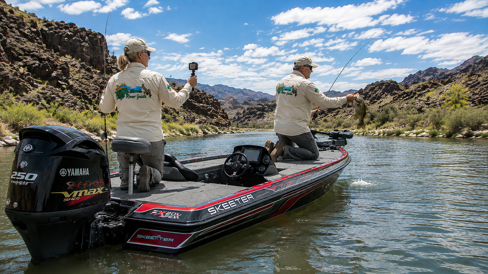
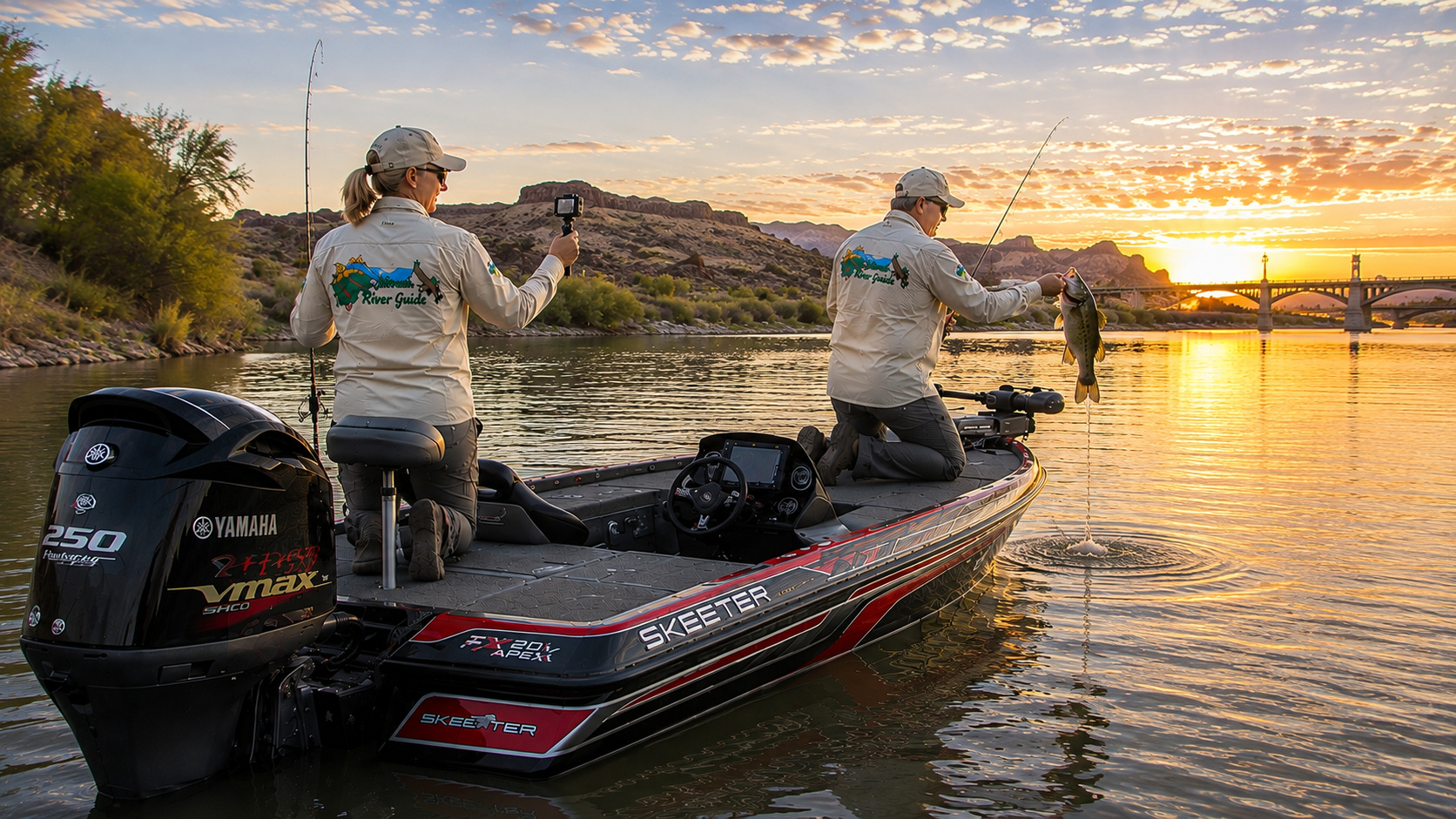
The Skeeter settles into the river.
Yamaha warming behind us.
Paulette has a rod on the rear deck and a camera close by because we've learned that the best wildlife photographs tend to appear while the camera is safely packed away.
We idle south.
The sun hasn't reached the canyon walls yet.
Water beneath us changes from silver to blue.
I watch the depth finder.
Watch the channel.
Watch ahead.
A great blue heron lifts from the reeds.
Then the river narrows.
Rock rises around us.
Topock Gorge.
I bring the boat off plane before reaching the water I want to fish.
Trolling motor down.
Now I'm watching the current.
There's a rocky point ahead.
Water hits the upstream side, splits around it and creates a soft pocket downstream.
That's where I'd live if I were a smallmouth.
I make the cast upstream.
The little swimbait swings naturally with the current.
One turn of the reel.
Two.
The line jumps.
I set the hook.
Bronze flashes beneath the surface.
Smallmouth.
Not enormous.
Doesn't matter.
The fish uses the current and fights like something twice its size.
Eventually I kneel beside the trolling motor and lip her.
Paulette already has the camera.
Naturally.
One photograph.
Back she goes.
We sit there a moment.
No hurry.
A bighorn appears high on the rocks.
Paulette raises the camera again.
The sun finally reaches the canyon wall and turns it orange.
That's when Topock Gorge is at its best.
Before the crowds.
Before the heat.
Before the river fills with engines.
Just moving water, desert rock, wildlife and a fisherman who has been fortunate enough to spend a lifetime doing this.
Later in the day, things change.
Fast boats arrive.
Traffic increases.
Wakes rebound from shorelines.
And unfortunately, some people mix horsepower with alcohol.
That's when I become considerably more defensive.
I stay alert.
I assume the other operator may not see me.
I slow down around blind bends and shallow water.
I keep the life jacket on.
And I never allow the desire to reach another fishing spot five minutes sooner to override common sense.
I've been around airplanes and boats long enough to understand something:
The best trip isn't the one where we catch the biggest fish.
It's the one where Paulette and I come home safely and get to go again tomorrow.
That is particularly true on this stretch of the Colorado River.
Topock Gorge is beautiful.
It's wild.
It's historically important.
It's excellent bass water.
And under the right conditions, it can be dangerous.
Respect all five of those things and it becomes one of the finest river trips in the Southwest.
Eventually the canyon walls begin pulling away.
The river broadens.
Water slows.
And ahead of us lies another lake Paulette and I have come to love.
Lake Havasu.
That's where we're going next.
And I already know which rods I'm putting on the front deck.
0 Comments